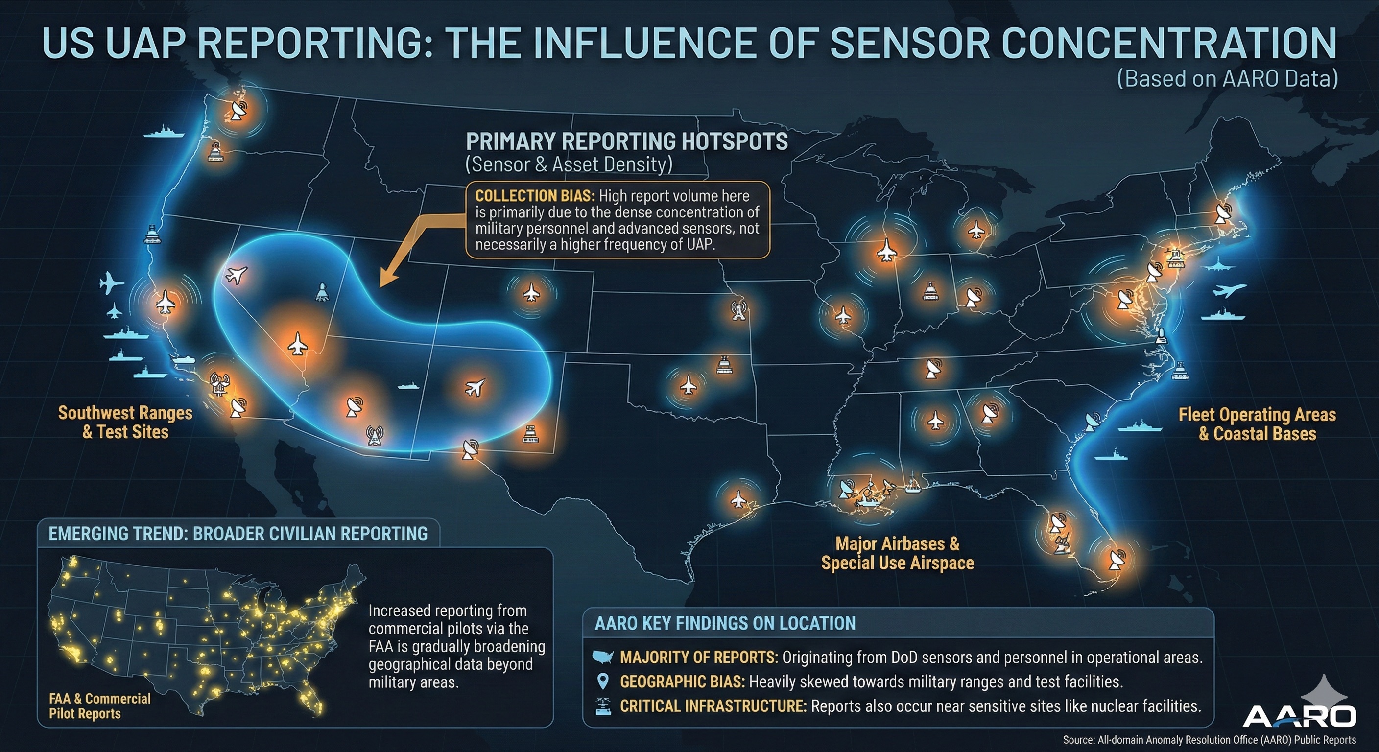
Map of the contiguous United States displaying UAP reporting locations overlaid on regions of high sensor concentration. Annotations highlight reporting hotspots, collection bias, broader civilian reporting trends, and AARO findings on DoD sensor origins and geographic patterns.
More From This Group