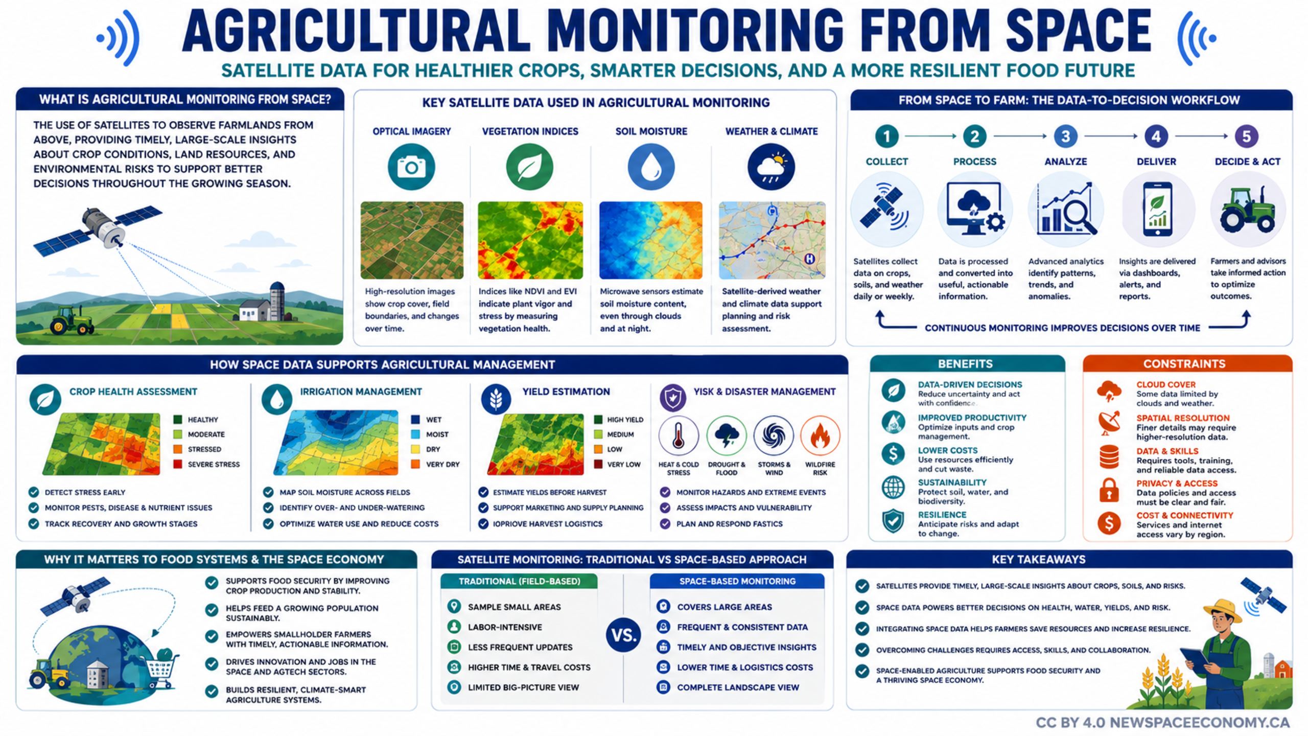
An infographic explains how satellite observations support crop health assessment, irrigation management, yield estimation, and disaster planning. It also outlines the benefits, limitations, and decision-making workflow involved in using space-based data across agricultural systems.
More From This Group