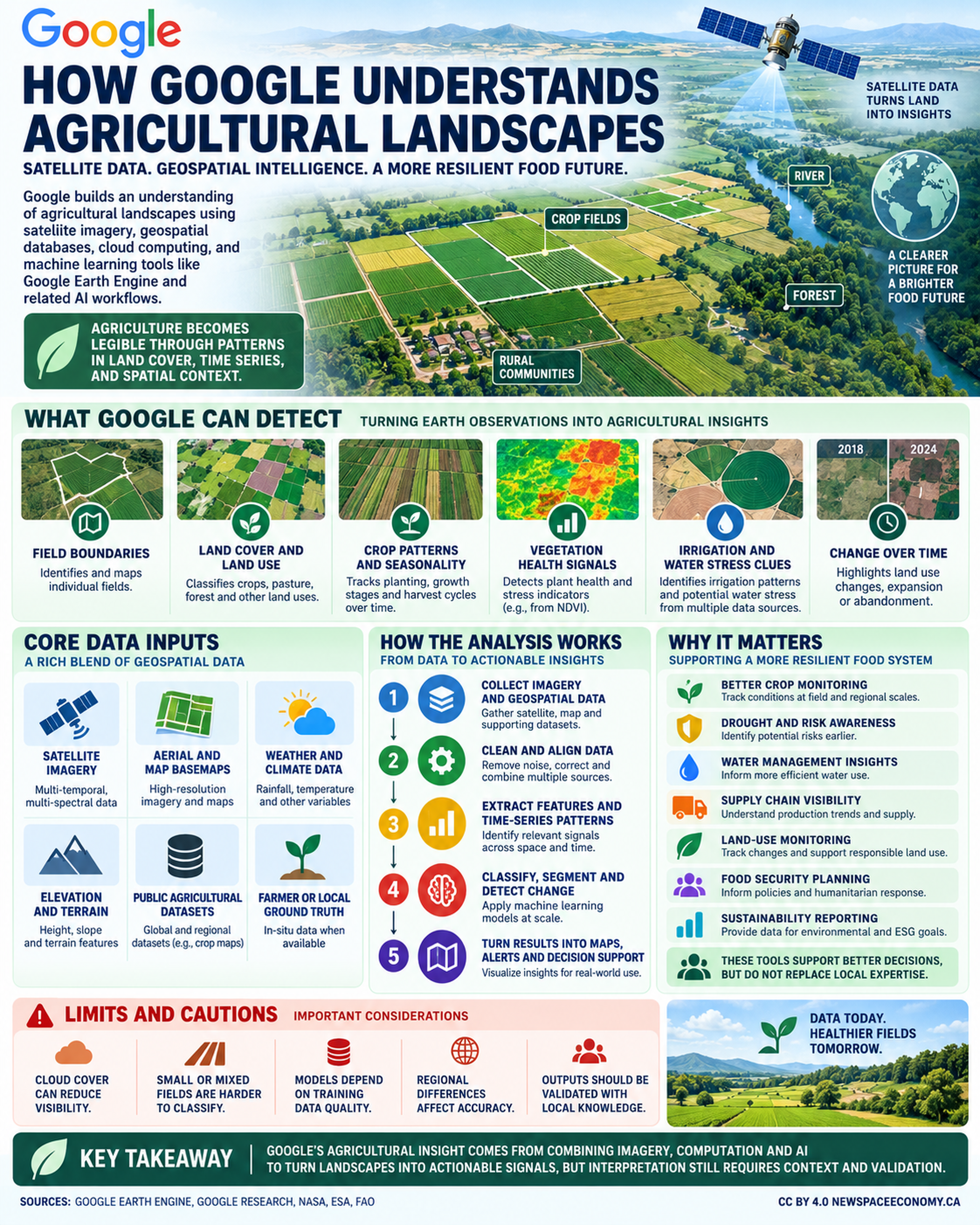
An infographic explains how satellite and geospatial data can support agricultural analysis. It covers observable signals such as field boundaries, crop patterns, vegetation health, irrigation, and land-use change, while noting the importance of data quality and local knowledge.
More From This Group