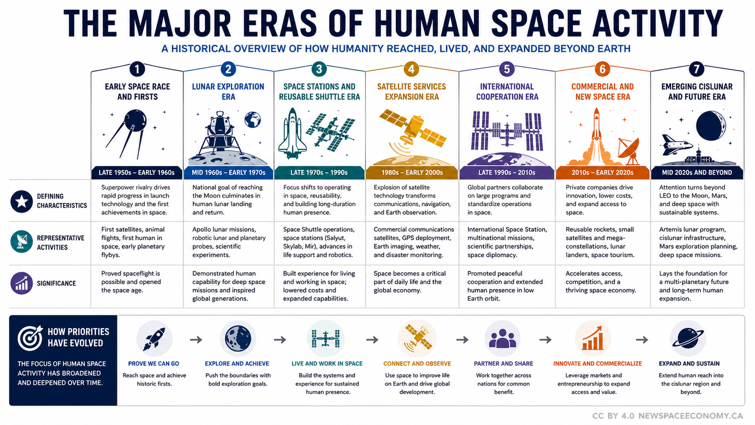
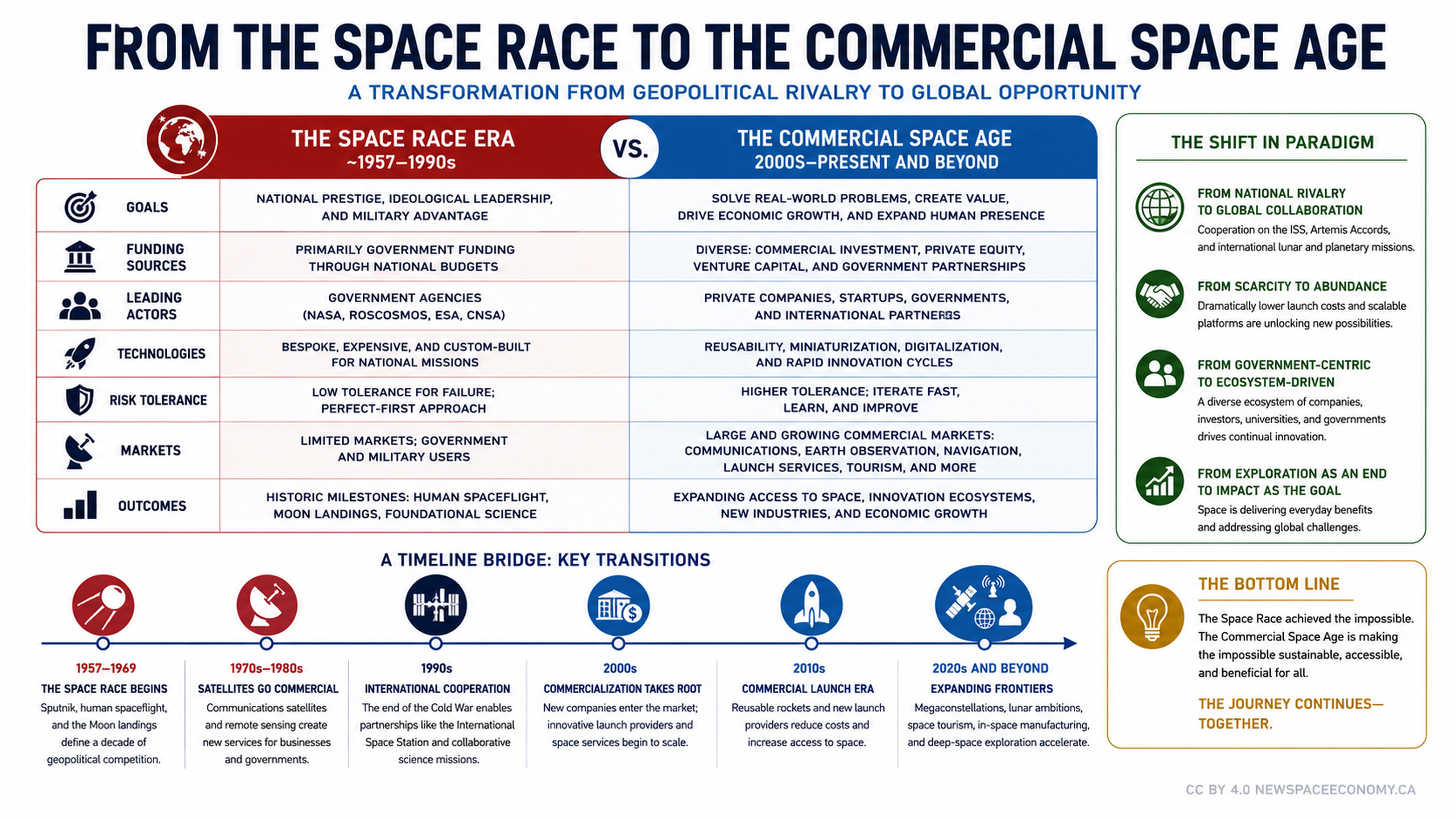
This infographic explains how satellite data can support disaster preparedness, response, recovery, and resilience. It covers applications ranging from hazard mapping and early warning to damage assessment, communications, recovery tracking, and humanitarian support.

More From This Group