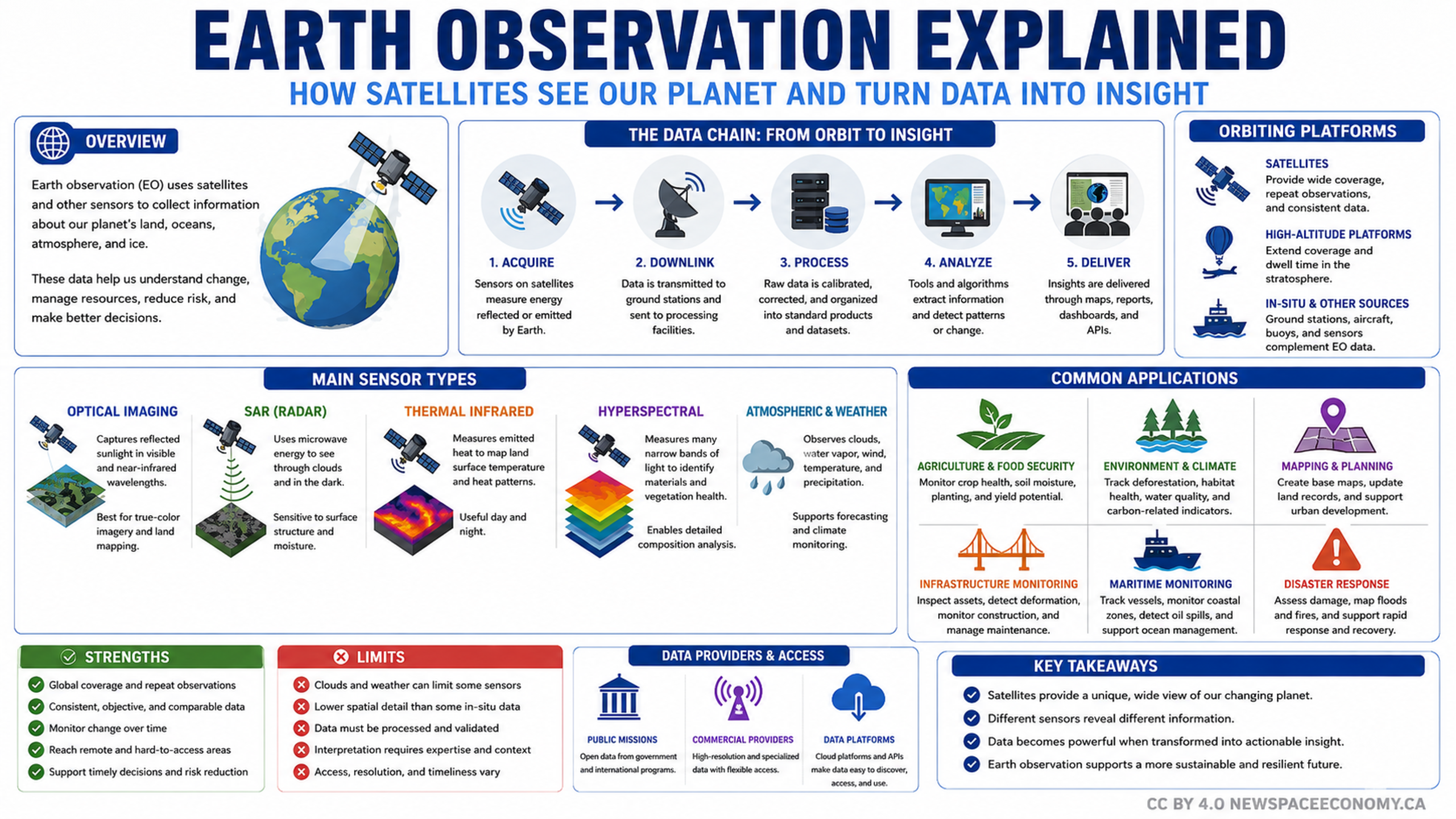
An educational infographic explains how satellite and other sensor data are collected, processed, analyzed, and delivered. It also summarizes sensing methods, applications in agriculture, climate, mapping, infrastructure, maritime monitoring, and disaster response, along with strengths and limitations.
More From This Group