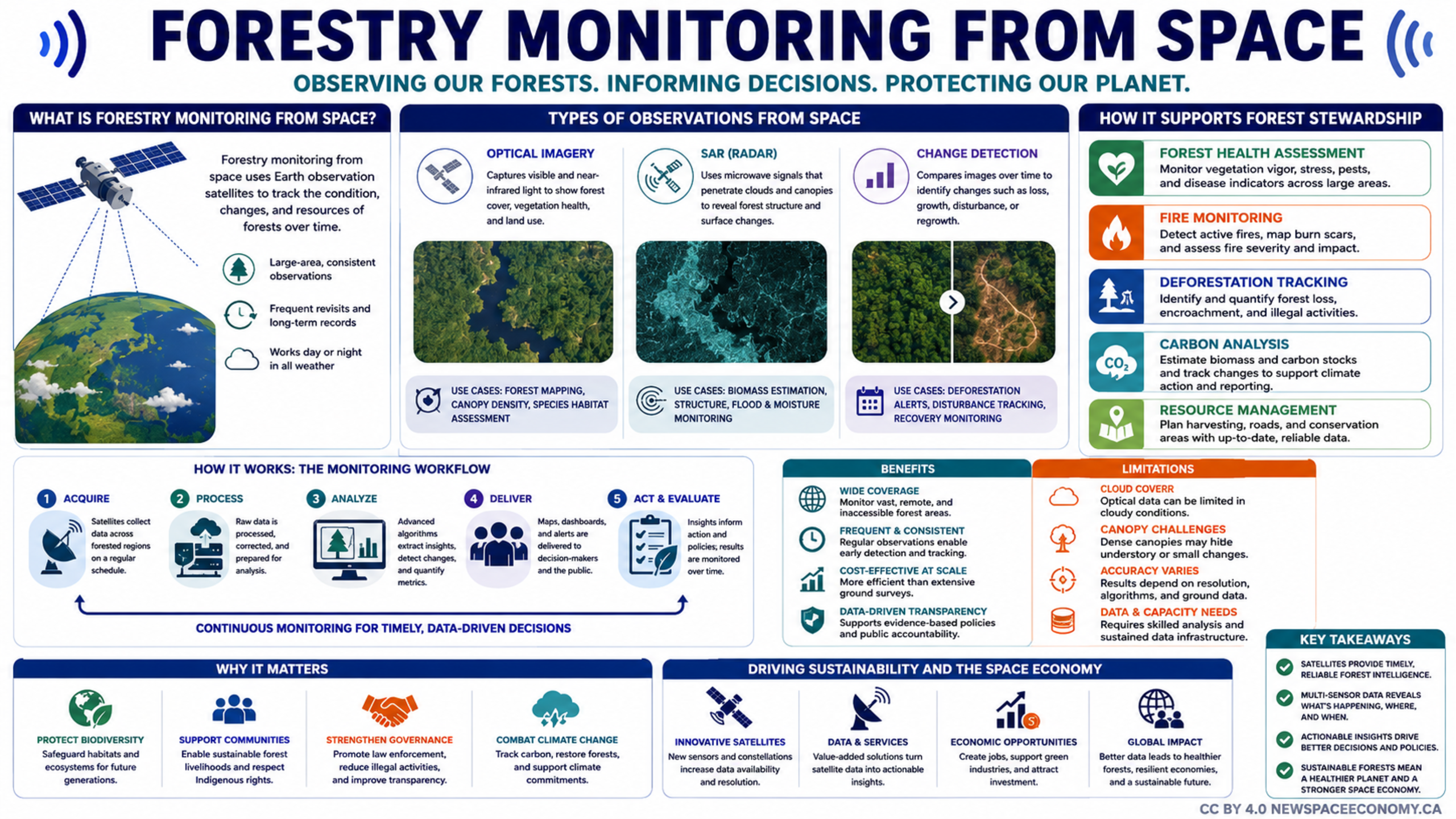
An infographic outlines how satellite observations support forest stewardship, from collecting and analyzing imagery to delivering actionable information. It describes applications including fire detection, deforestation tracking, carbon analysis, biodiversity protection, climate action, and sustainable resource management, while noting coverage benefits and observation limitations.
More From This Group