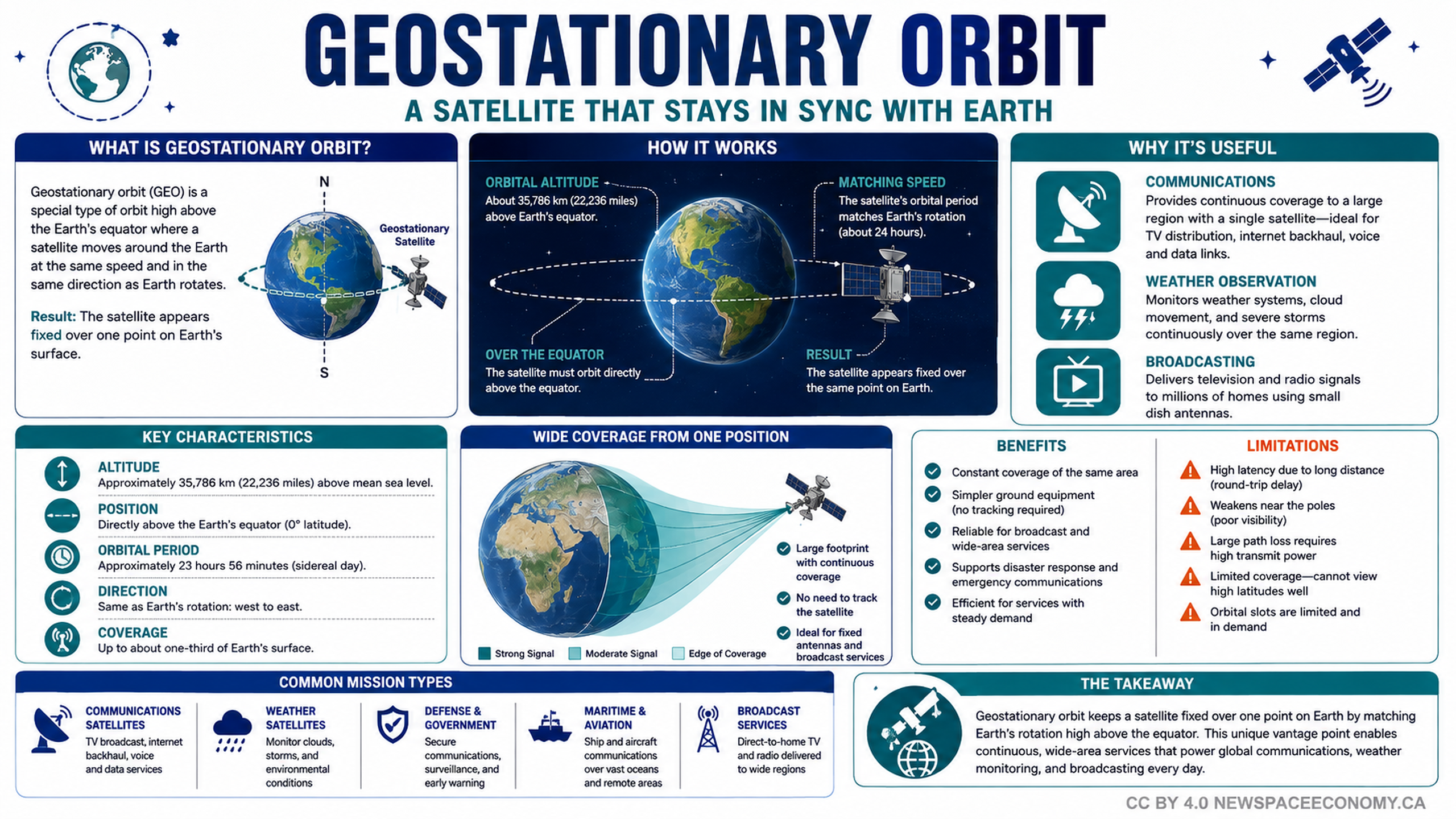
An educational space infographic explains how satellites remain aligned with Earth’s rotation above the equator. It outlines their altitude, coverage, operating characteristics, common missions, practical benefits, and limitations for communications, weather monitoring, broadcasting, maritime services, and government uses.
More From This Group