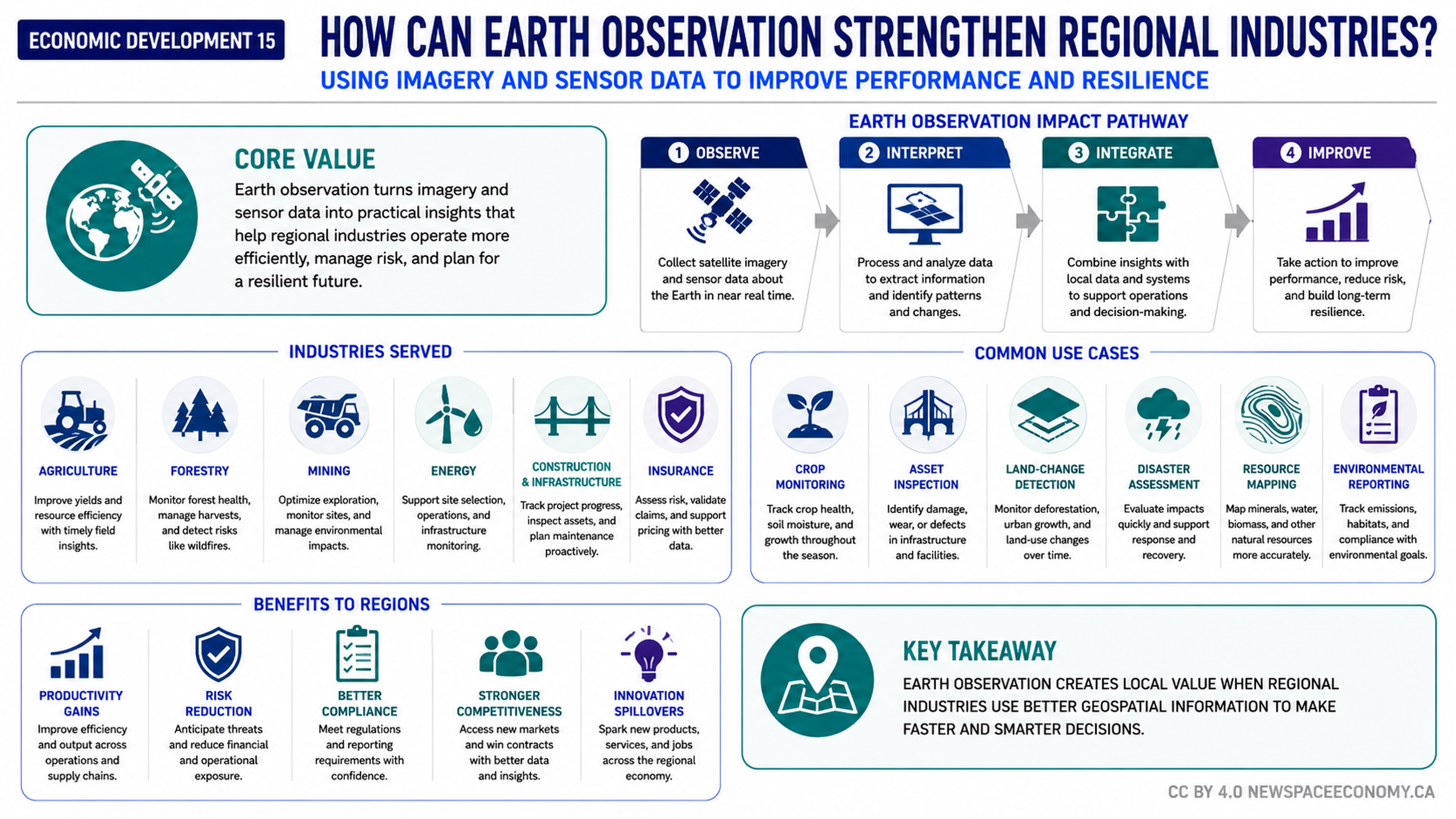
An infographic explains how imagery and sensor data can create practical value for regional industries. It outlines a four-step process from observation and interpretation to integration and operational improvement, with examples spanning agriculture, infrastructure, resource management, disaster response, and environmental reporting.
More From This Group