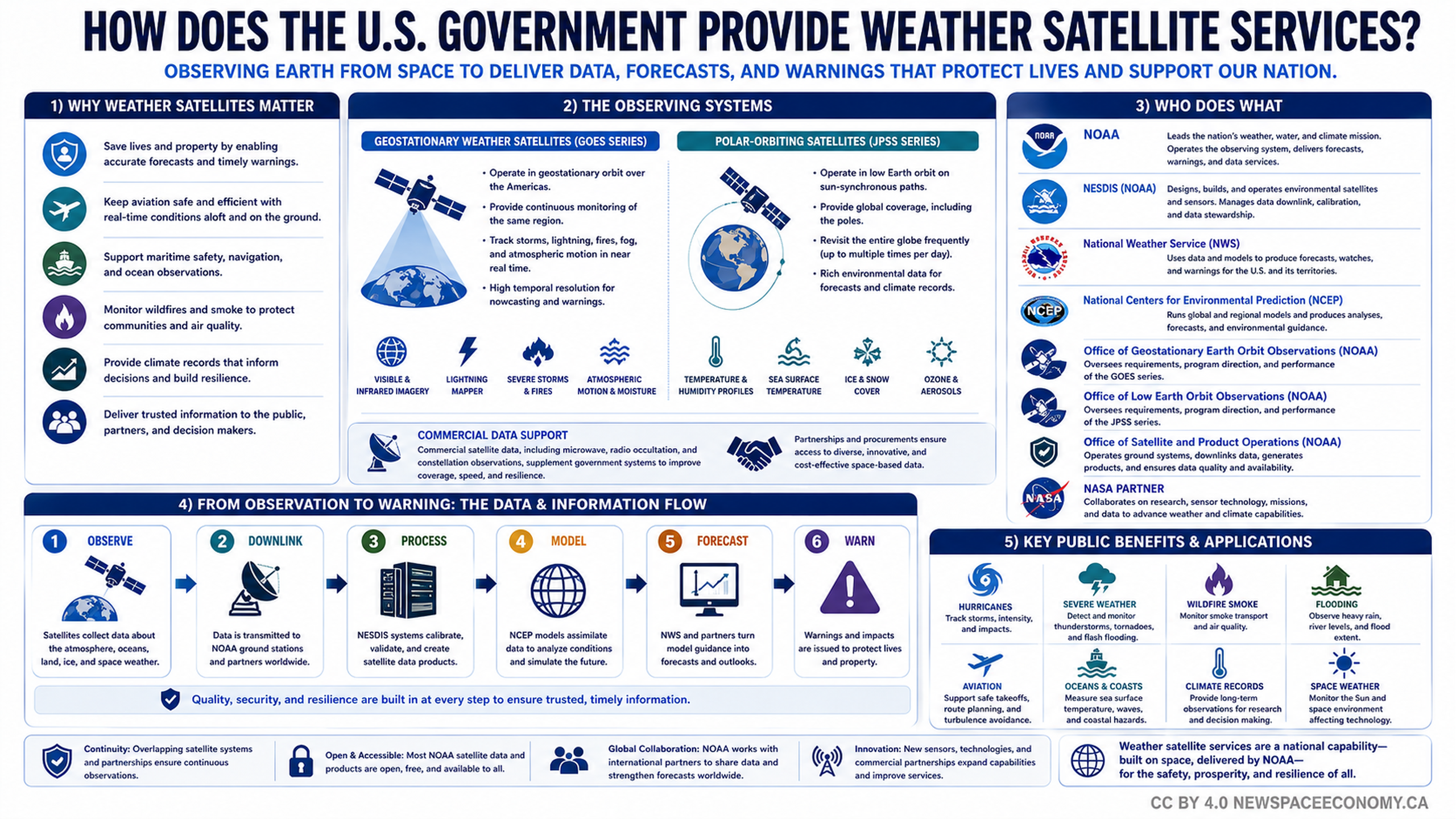
An explainer infographic traces how satellite observations become weather data, forecasts, and public warnings in the United States. It covers GOES and JPSS satellite systems, participating NOAA offices and NASA, commercial data support, and applications ranging from hurricane monitoring to aviation and climate records.
More From This Group