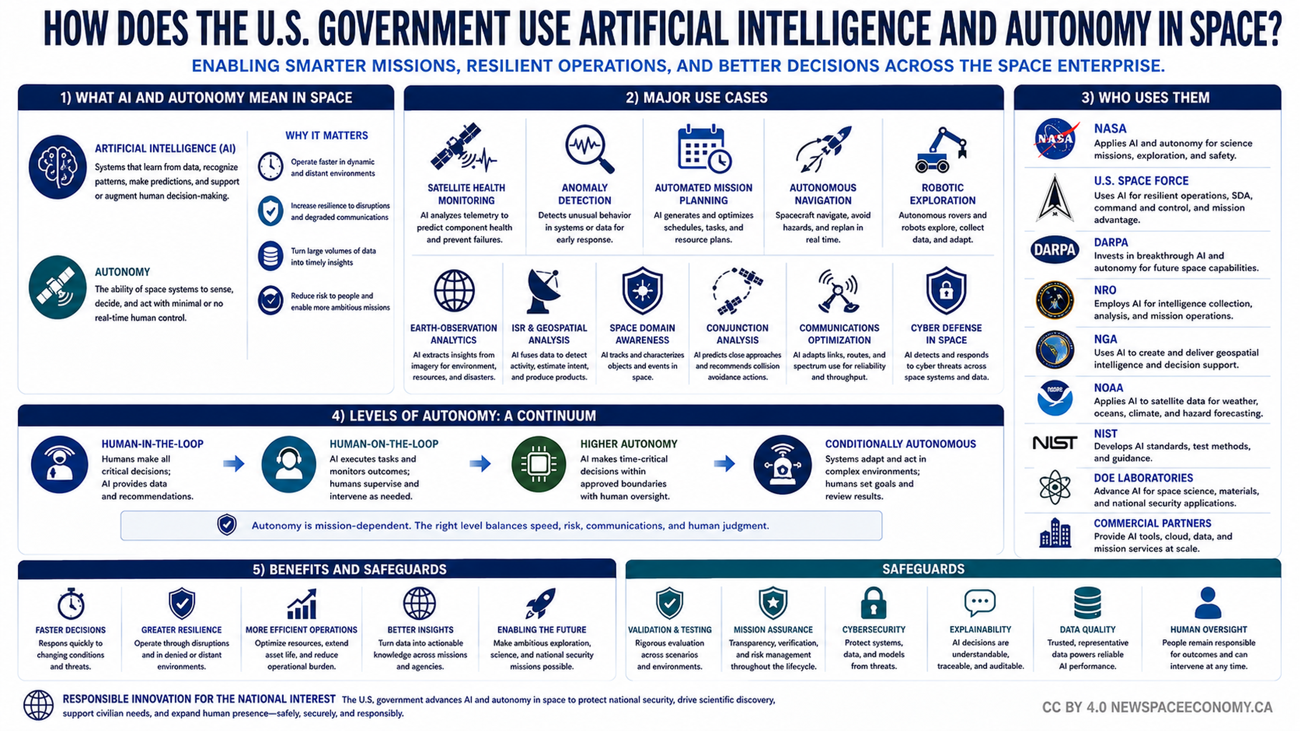
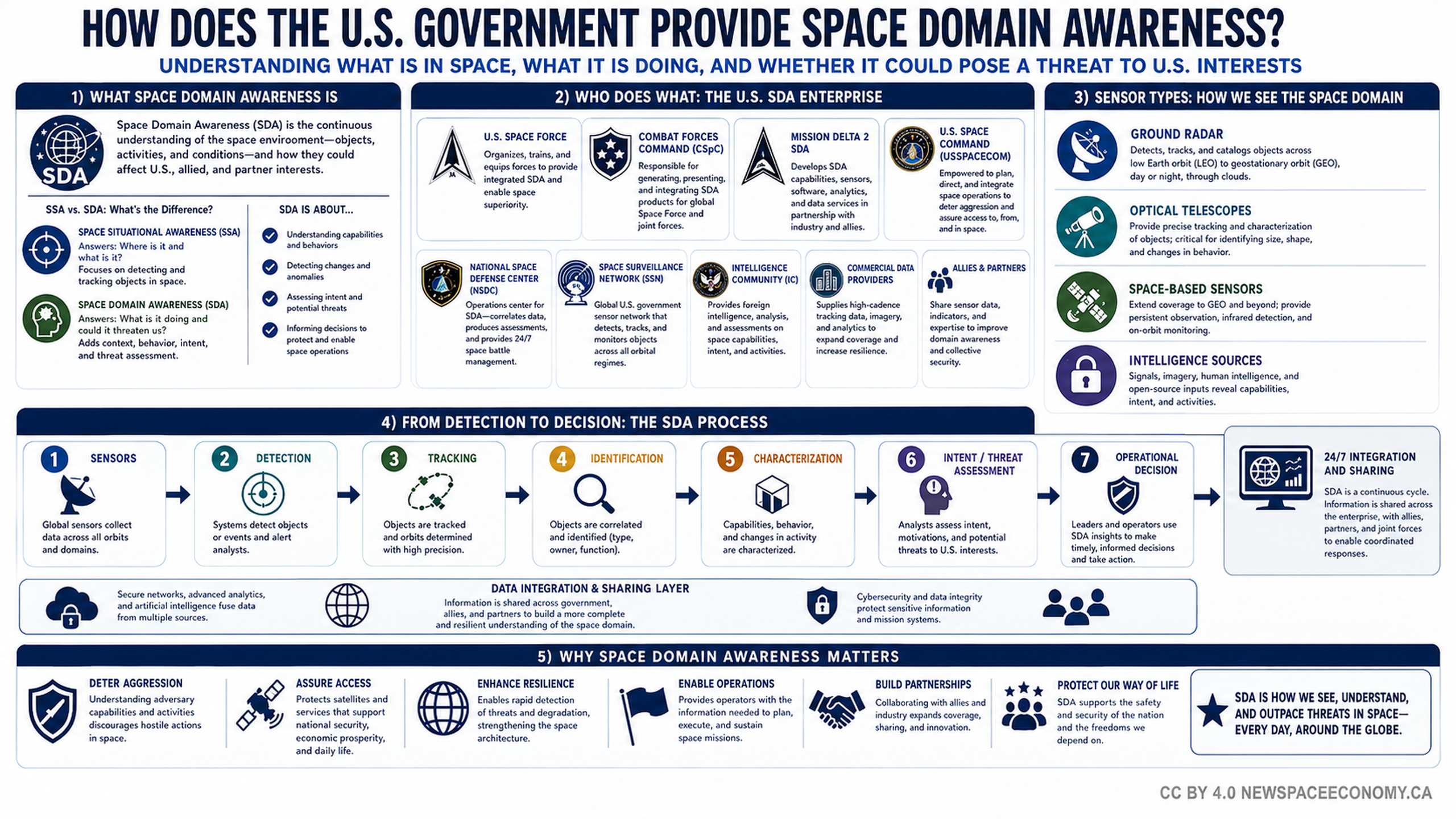
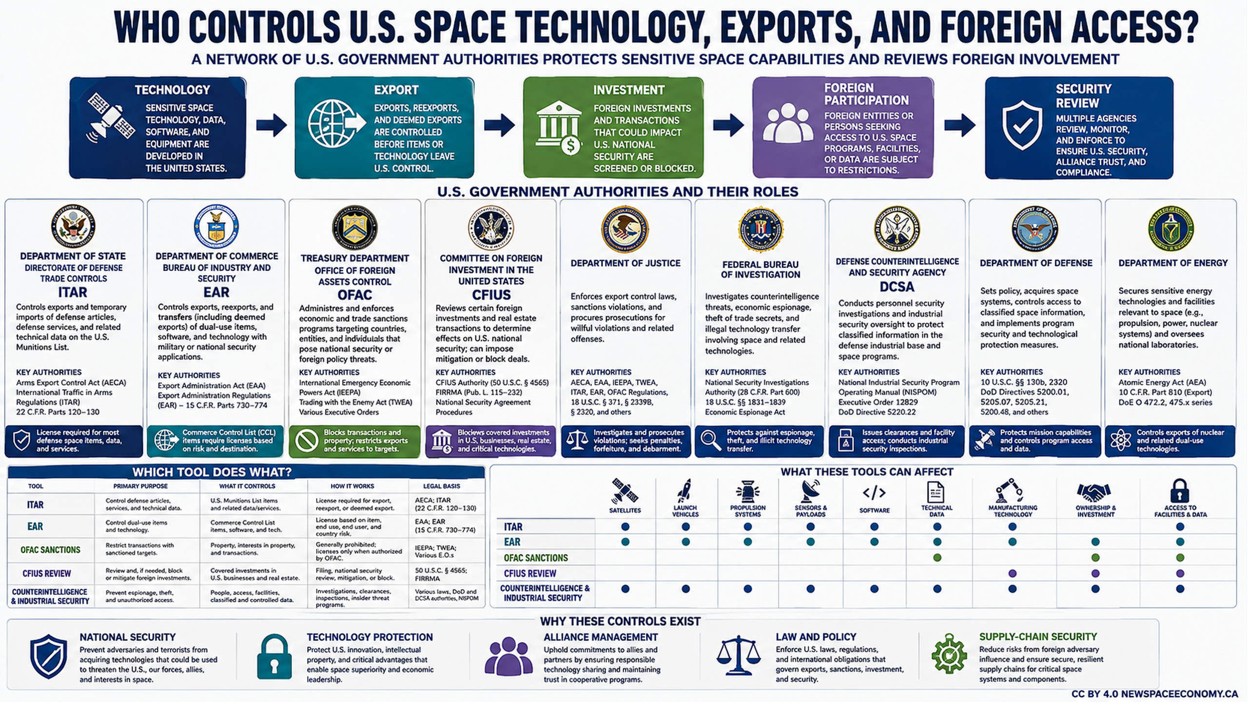
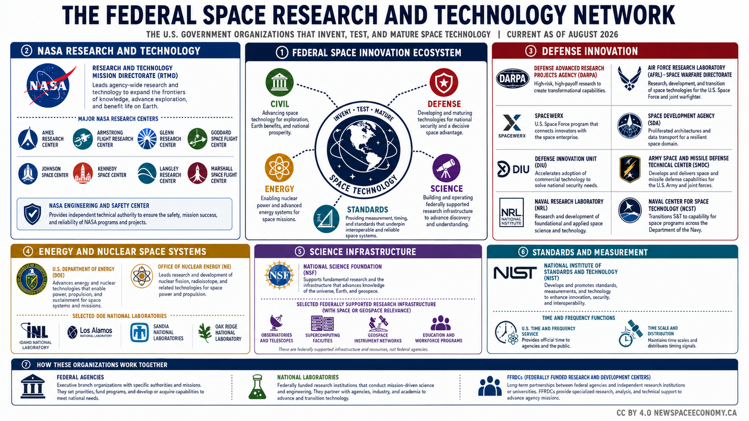
This infographic outlines the role of commercially supplied satellite information in U.S. government missions. It identifies participating agencies, data types, procurement methods, benefits and constraints, and the flow from satellite collection through analysis to federal use and public service.

More From This Group