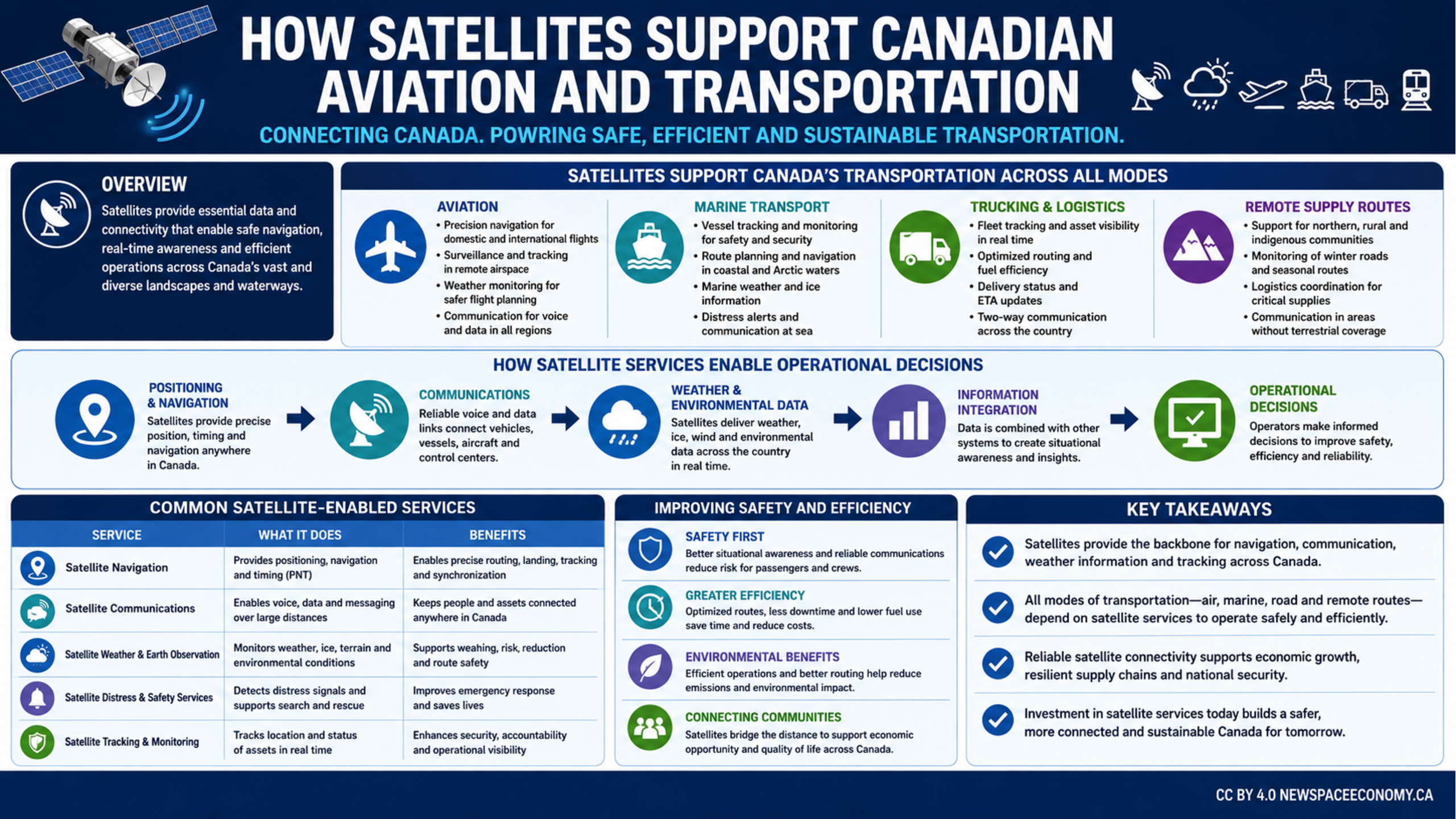
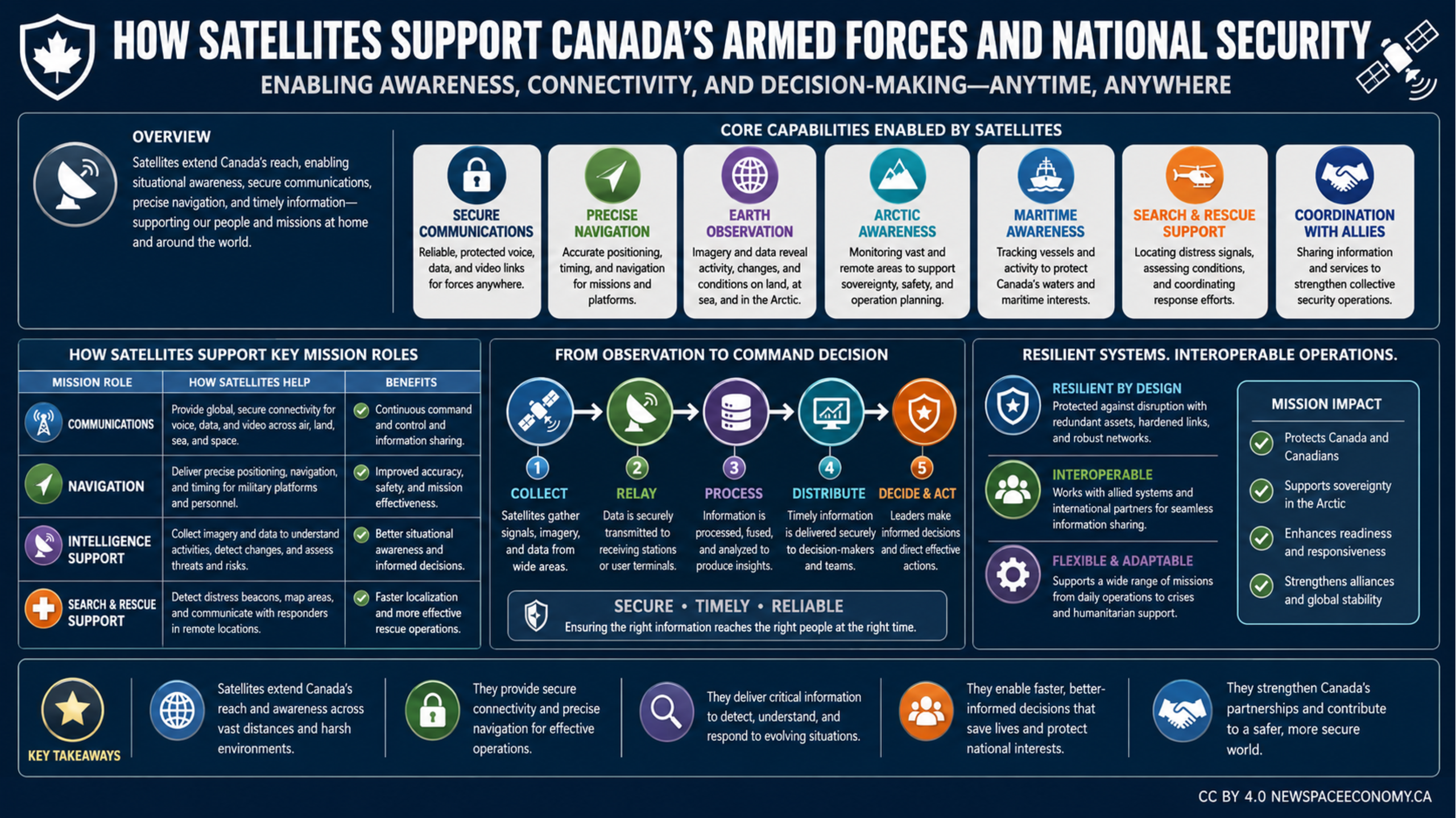
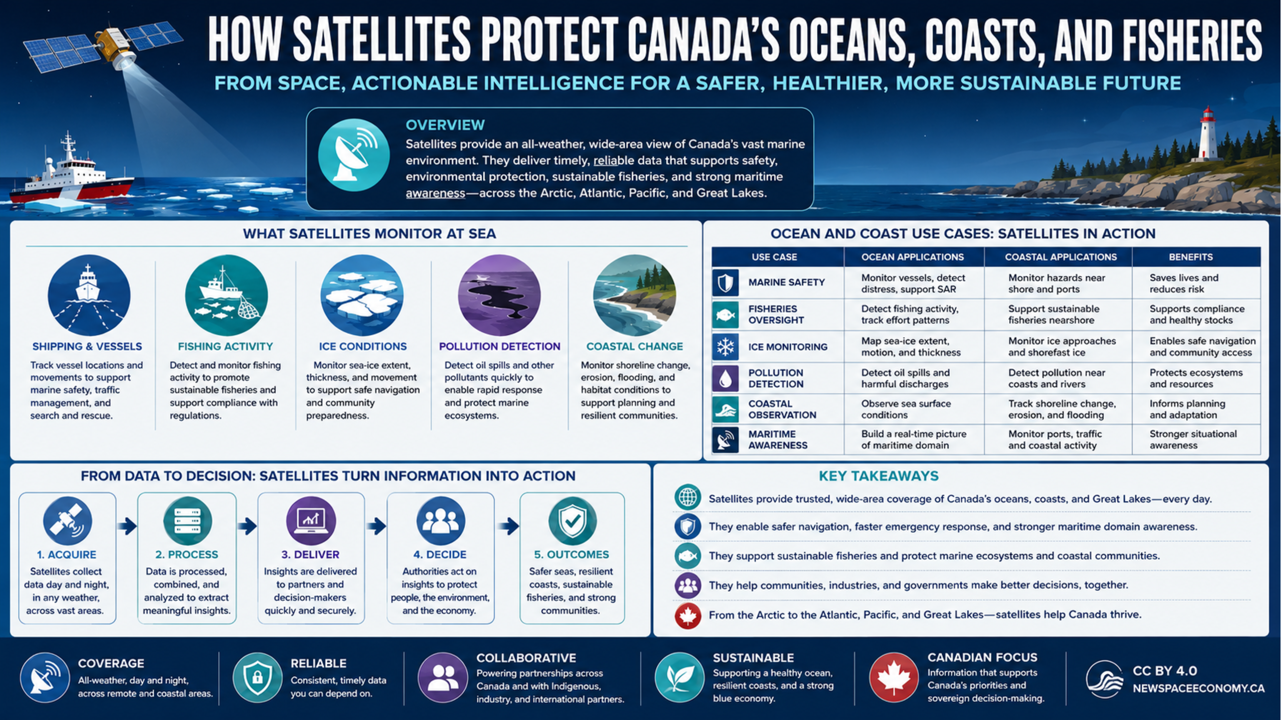
An infographic outlines how satellite data supports Canadian emergency management, from detecting fires, smoke, floods, and severe weather to informing decisions and supporting recovery. It also describes communications resilience and coordination among public agencies, responders, and communities.

More From This Group