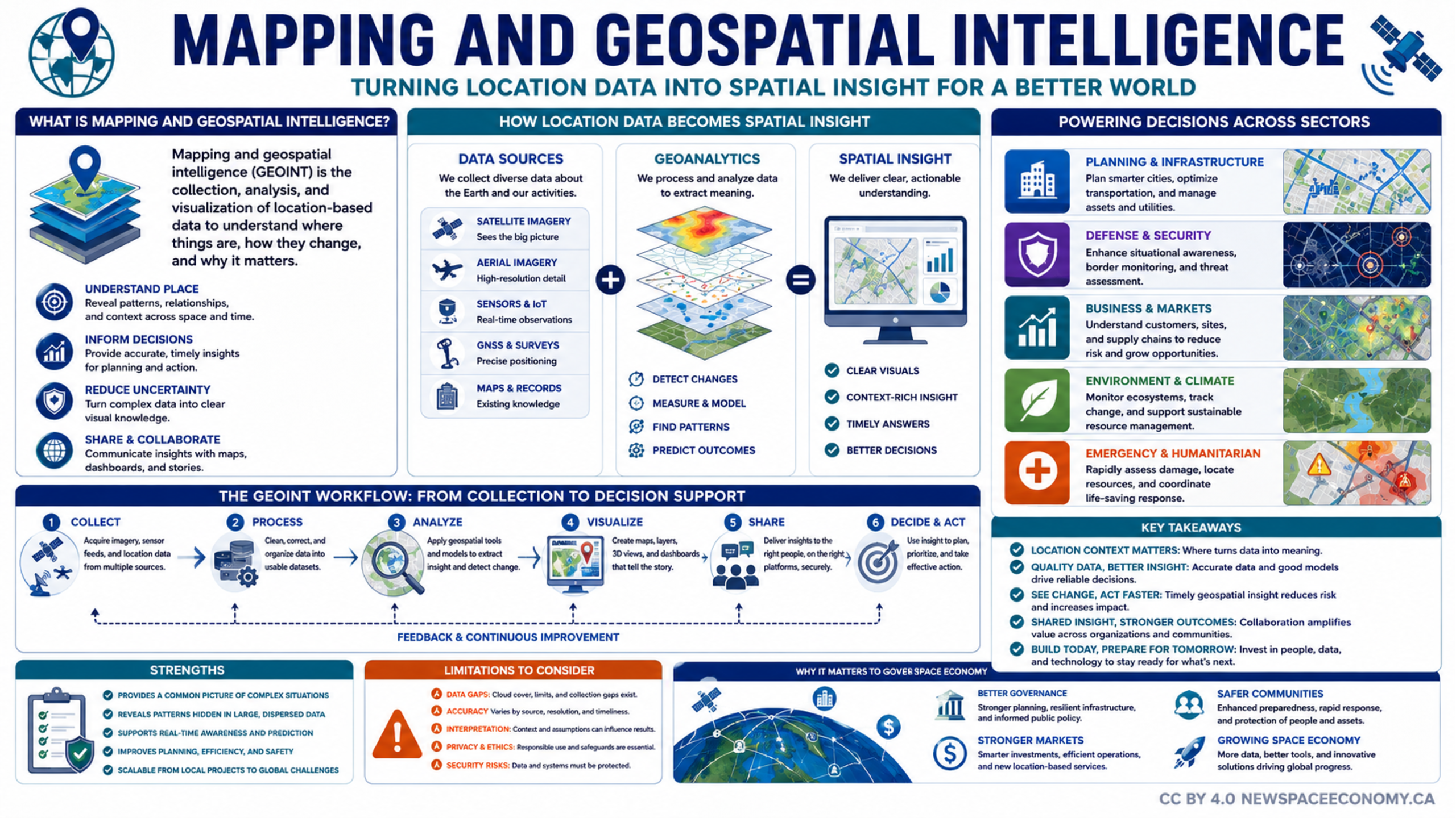
An infographic explains how location-based data is collected, analyzed, visualized, and shared to support decisions. It outlines applications across infrastructure, security, business, environmental monitoring, emergency response, and the space economy, while noting data quality, privacy, and security considerations.
More From This Group