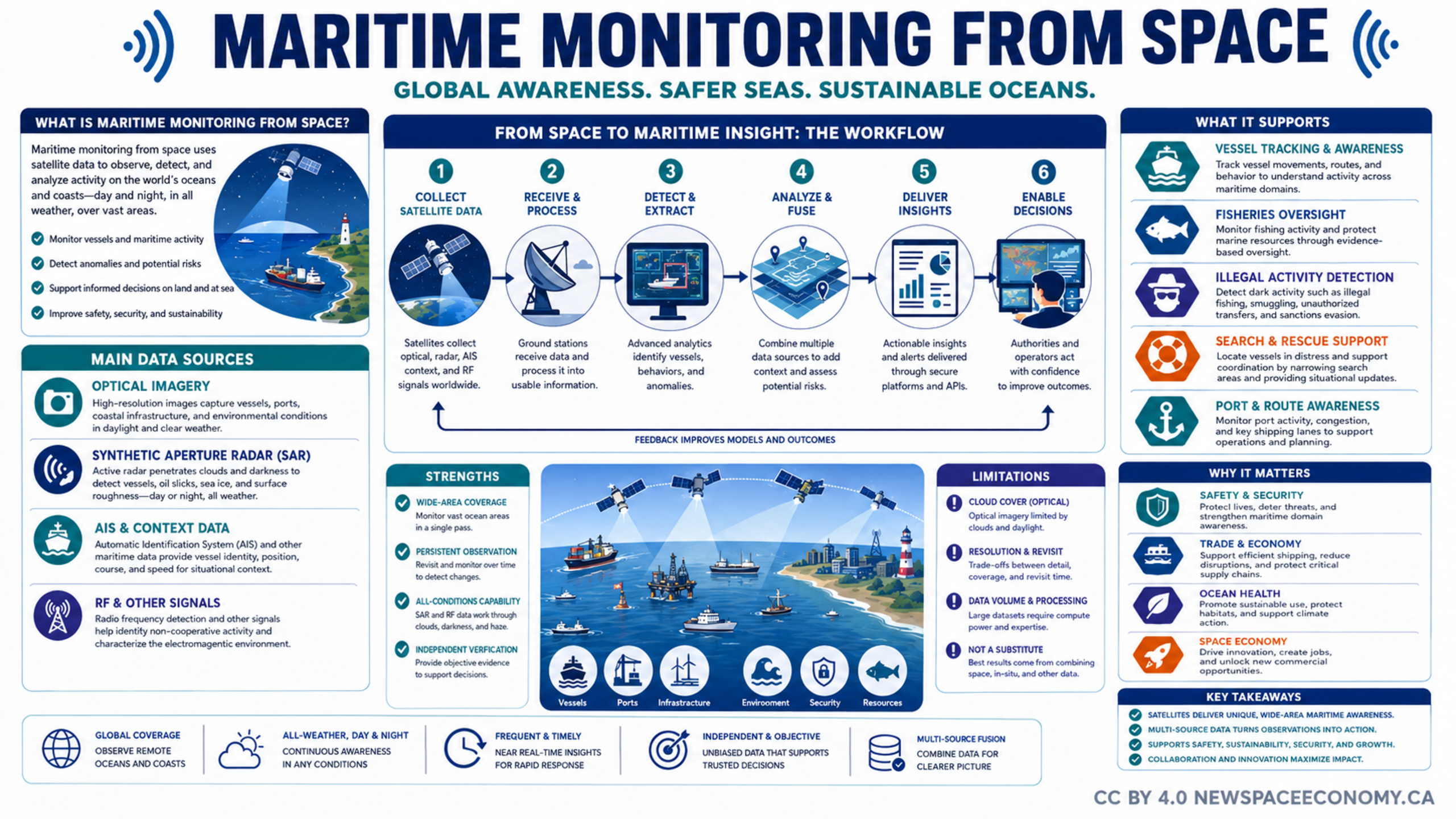
An infographic describes how satellite observations and related data support awareness of vessels, ports, infrastructure, resources, and ocean conditions. It presents the workflow from data collection through analysis and decision support, along with benefits, limitations, and practical maritime applications.
More From This Group