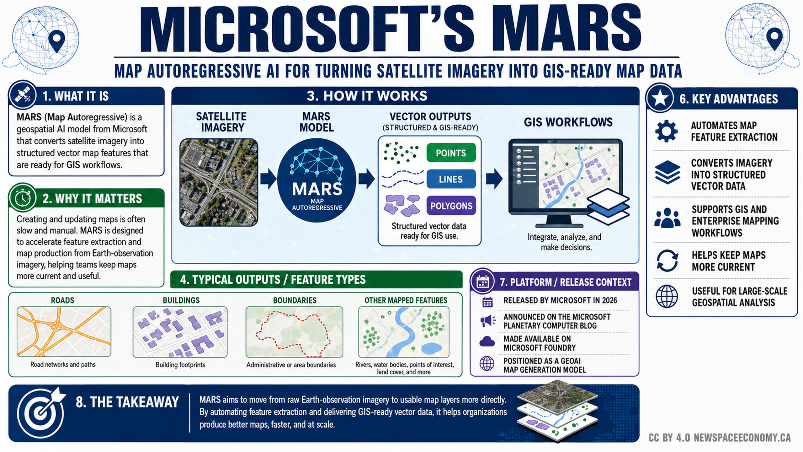
This infographic presents a Microsoft geospatial AI model that turns satellite imagery into structured vector data for GIS use. It outlines the processing workflow, common mapped features, stated advantages, and release context shown in the graphic.
More From This Group