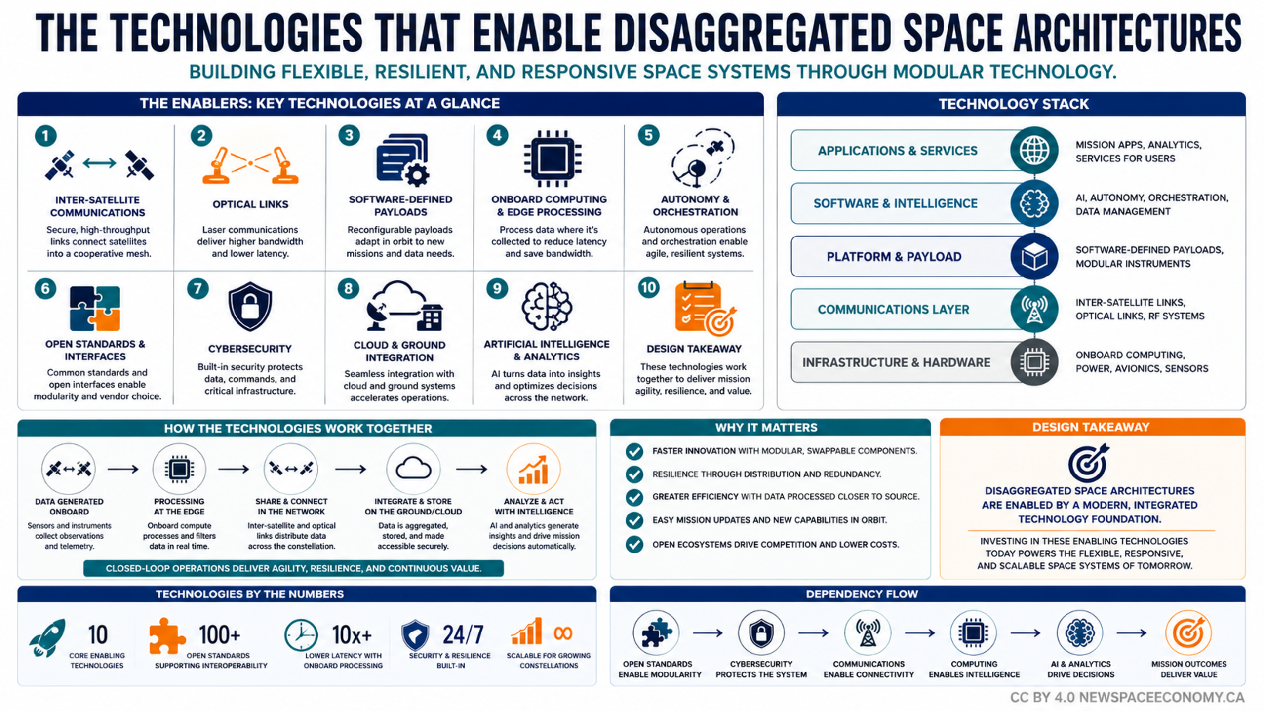
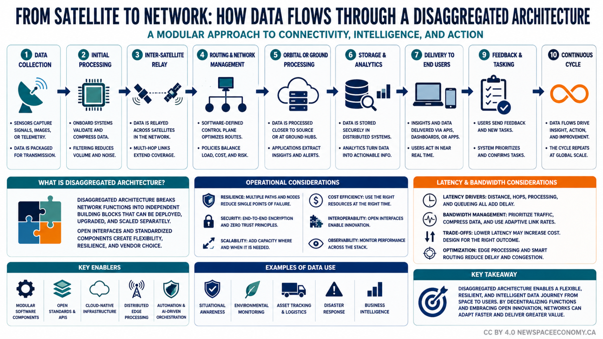
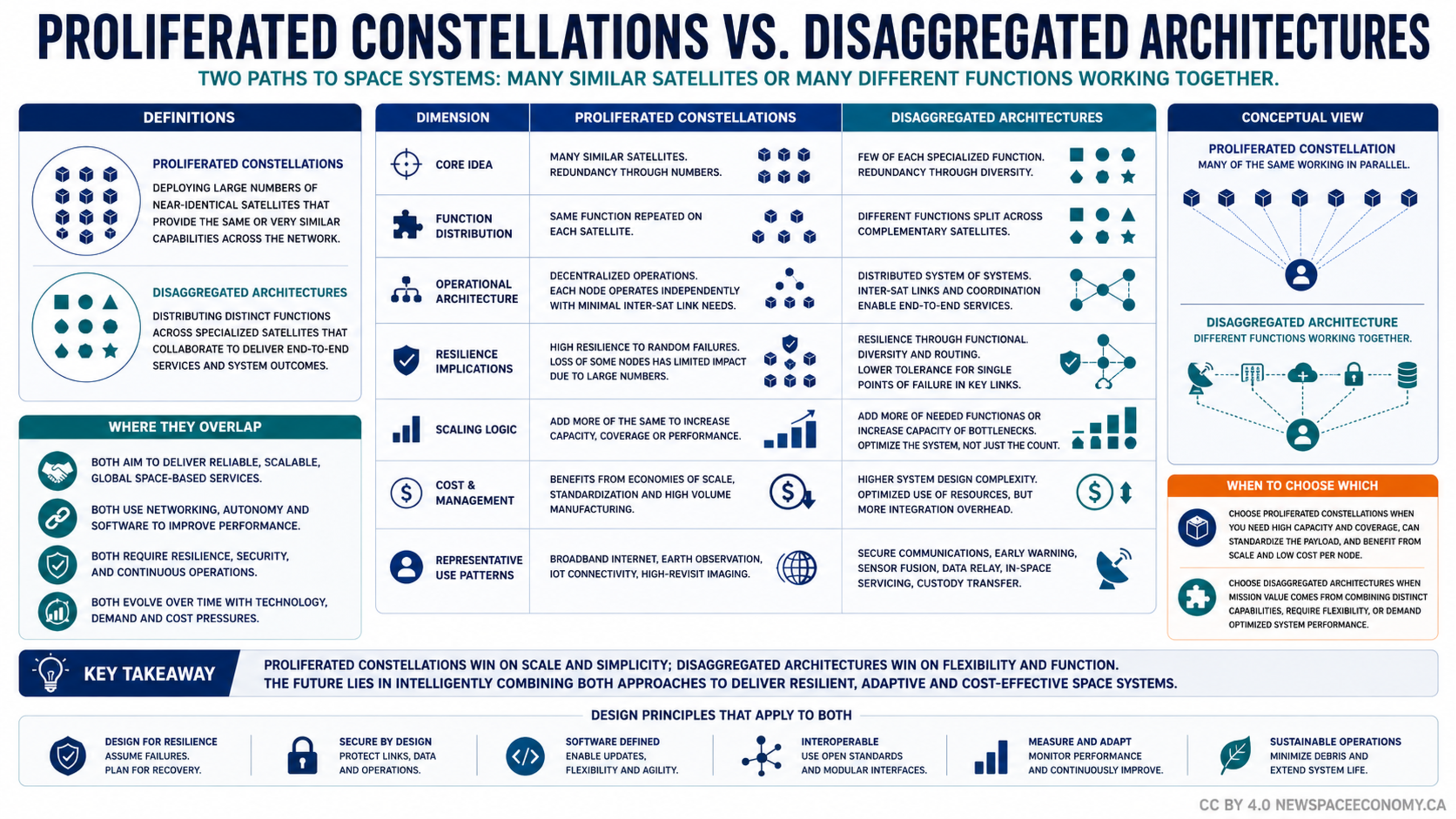
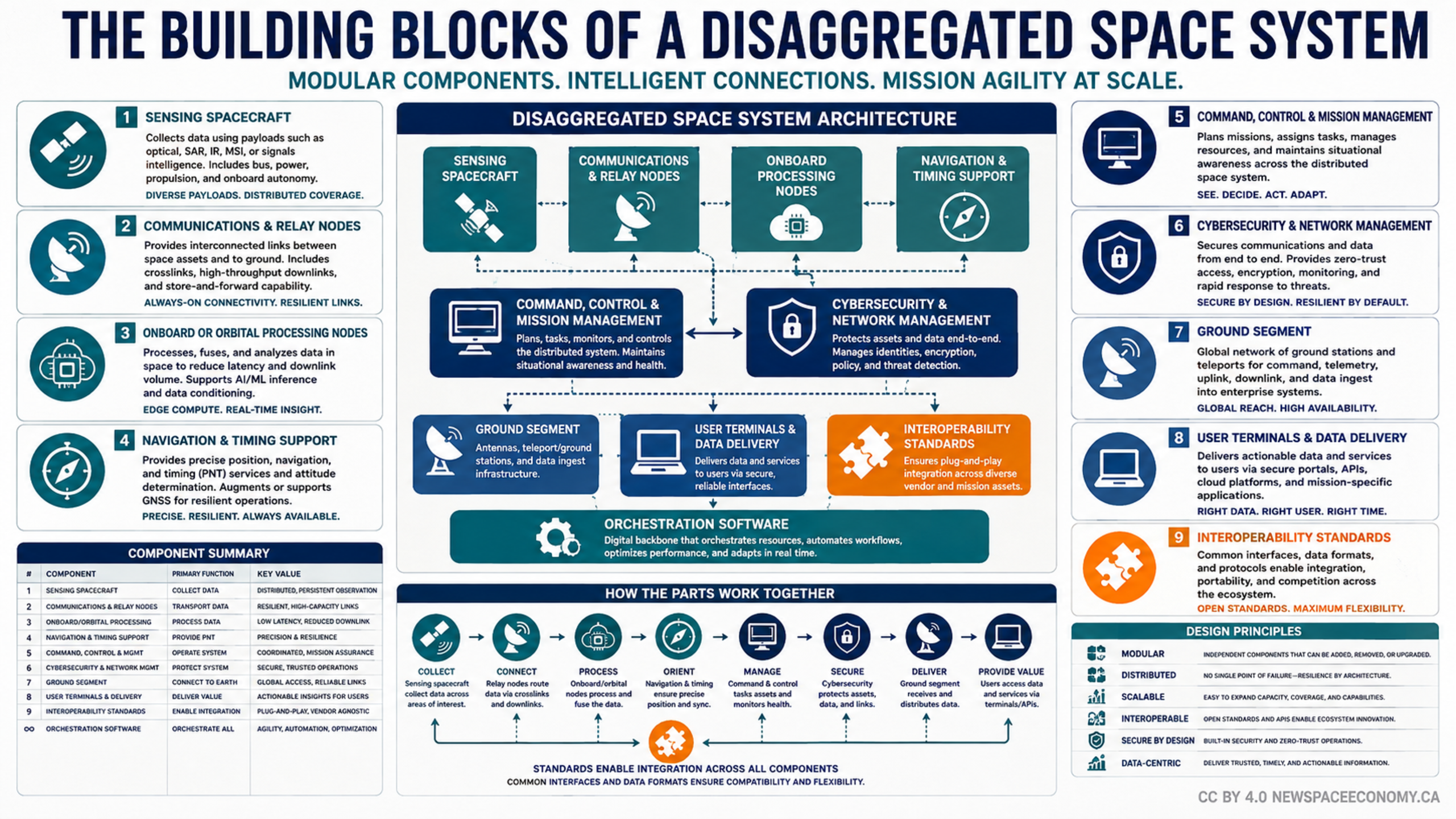
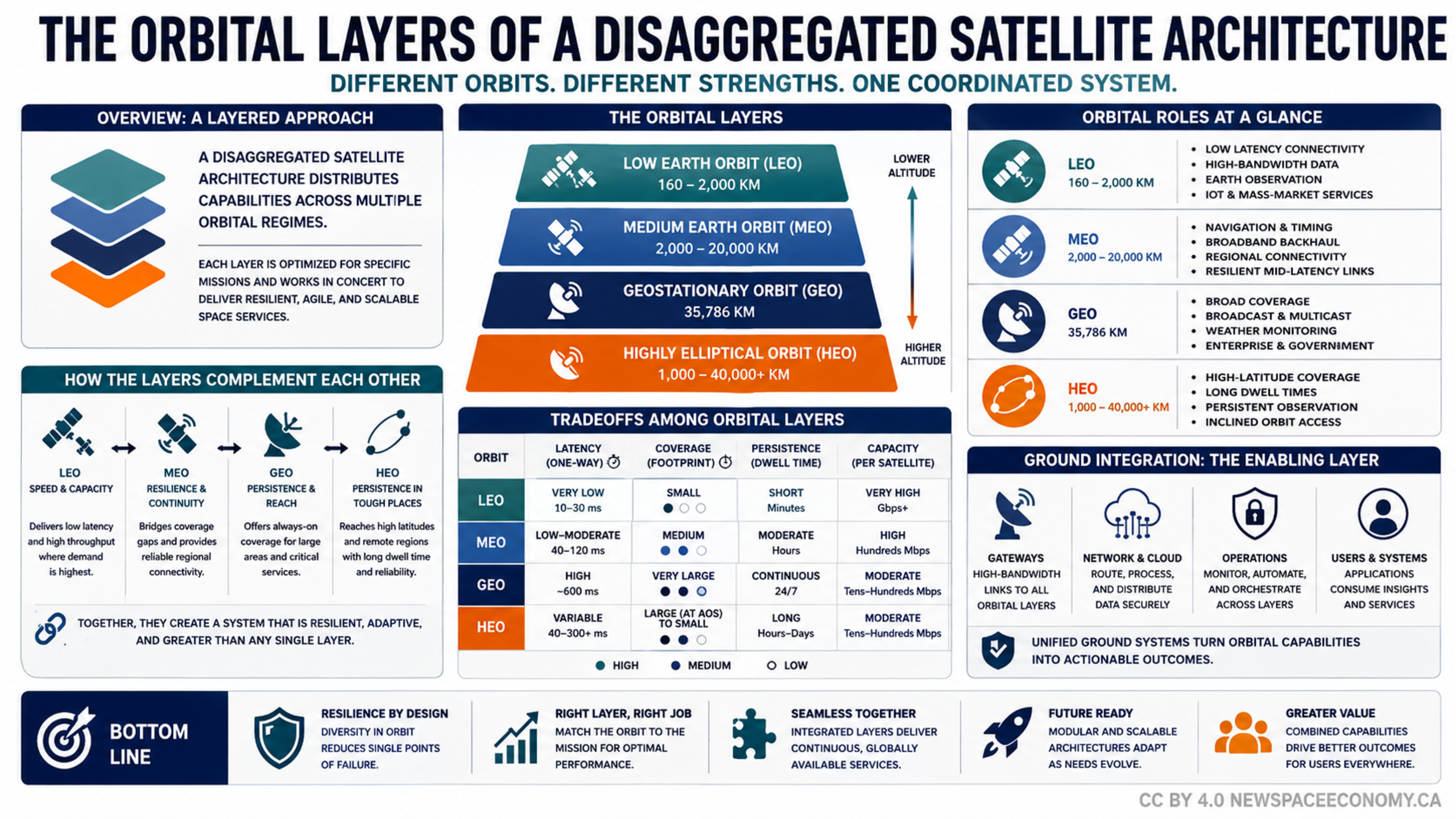
An infographic explains how LEO, MEO, GEO, and HEO can work together to provide complementary satellite capabilities. It compares altitude, latency, coverage, persistence, capacity, orbital roles, and the ground systems that connect space-based services with users.
More From This Group