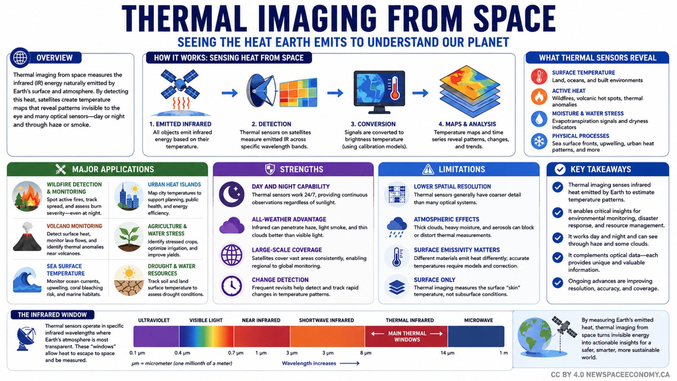
An educational infographic explains how satellite sensors measure infrared energy emitted by Earth and turn it into temperature information. It summarizes practical uses, technical strengths, measurement limits, and the infrared wavelength range relevant to observing environmental conditions.
More From This Group