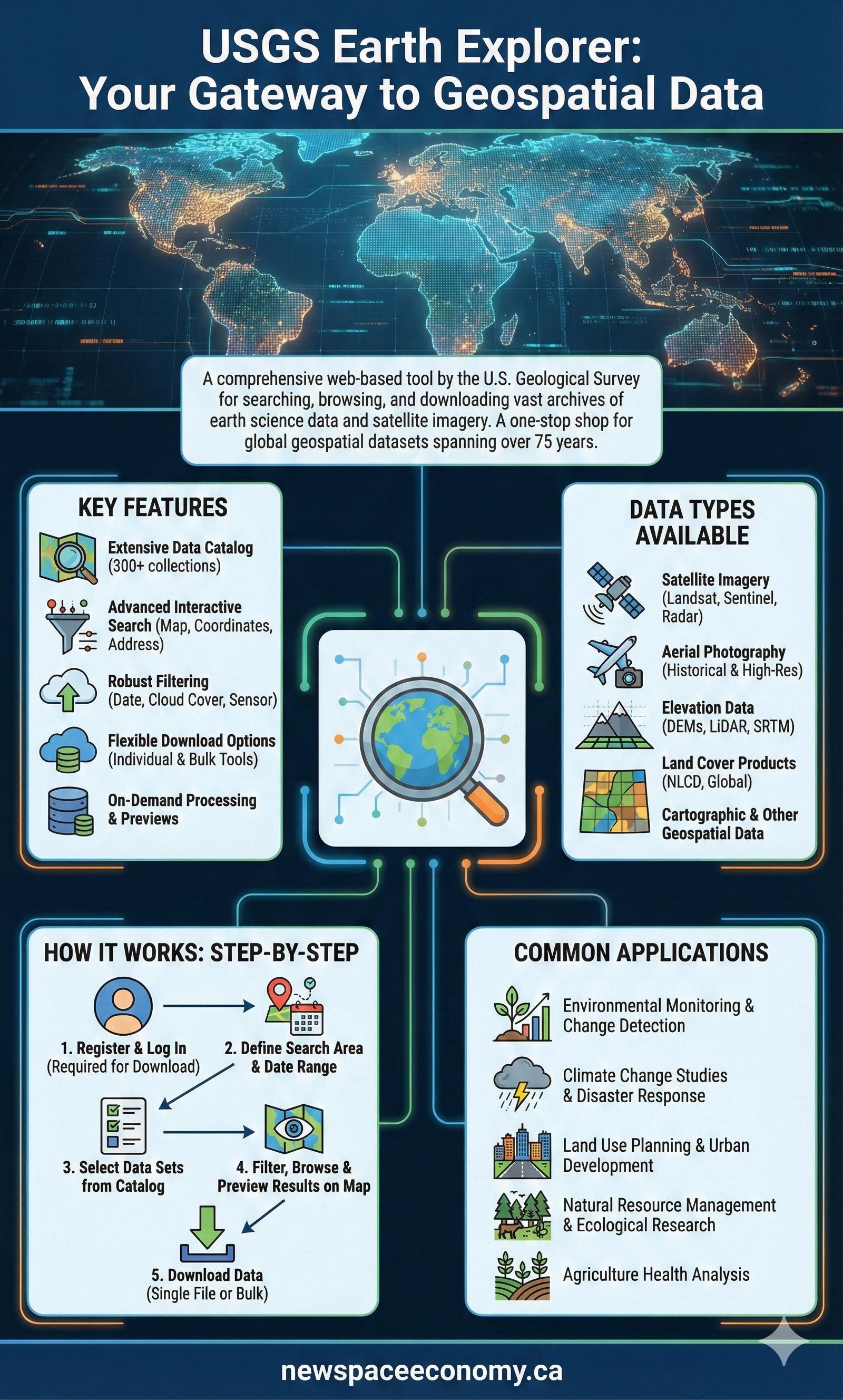
Infographic presenting the USGS Earth Explorer as a comprehensive web-based tool by the U.S. Geological Survey for accessing global geospatial datasets. It covers key features, data types available, a step-by-step usage guide, and common applications across environmental and planning fields.
More From This Group