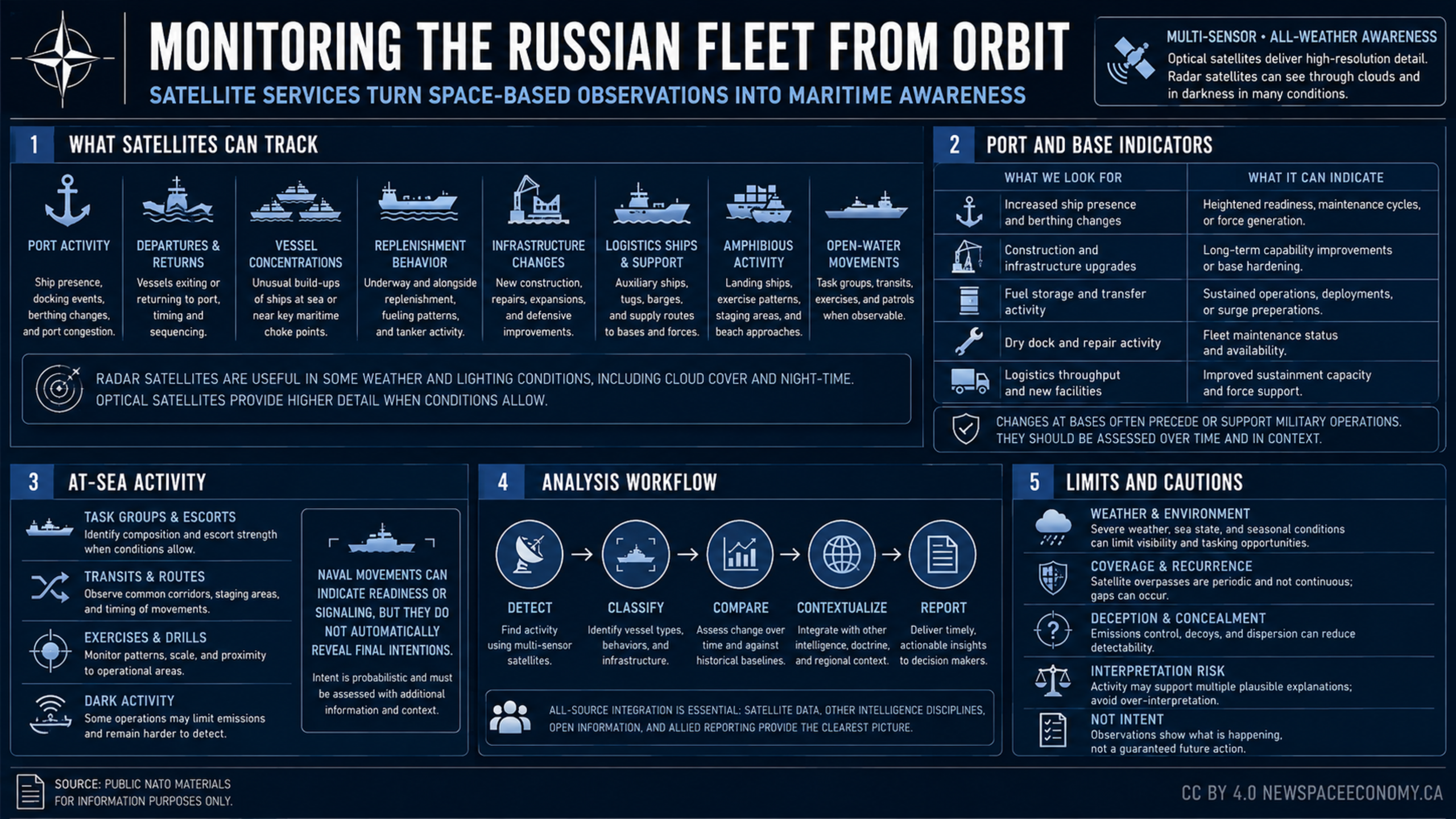
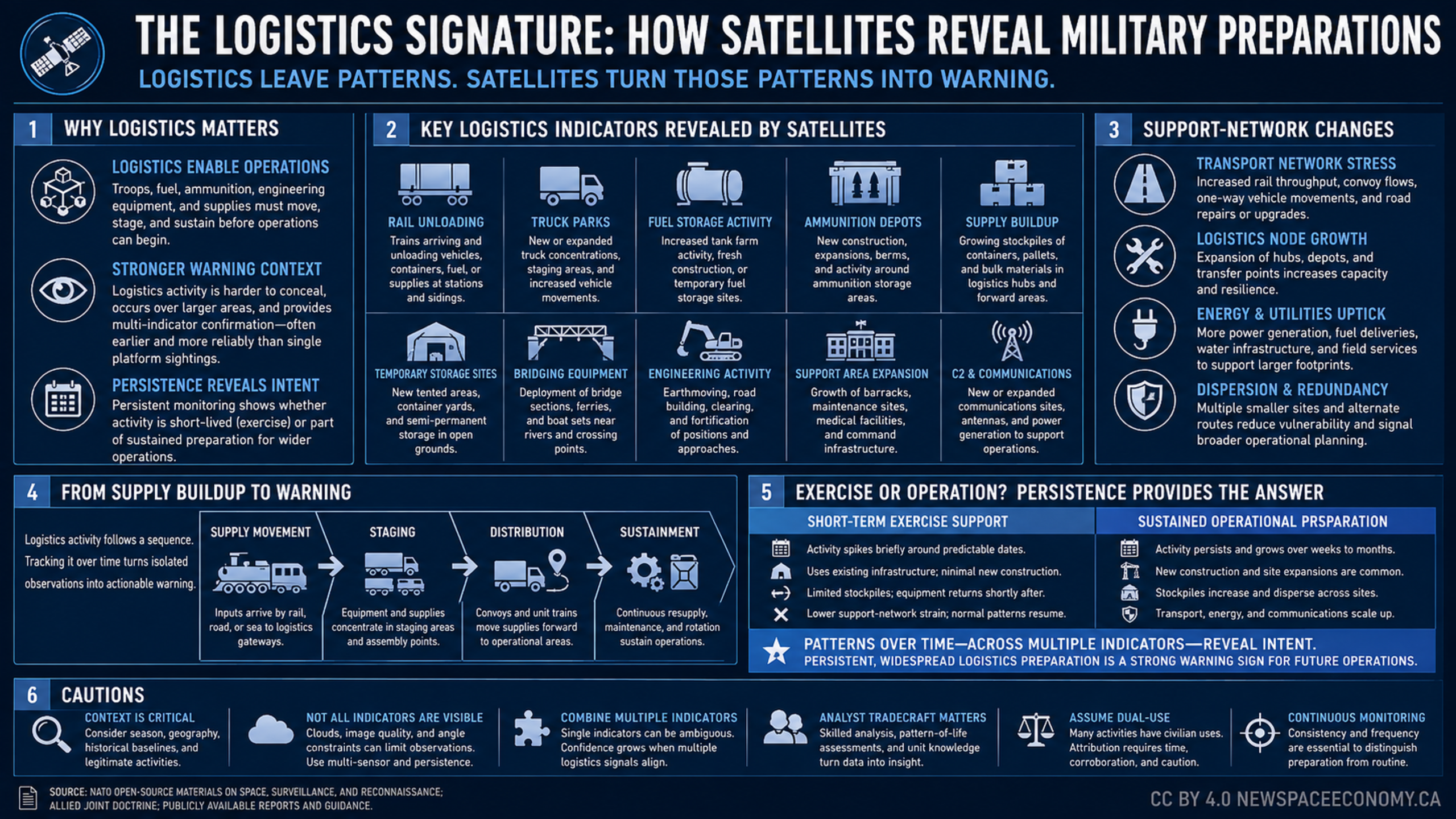
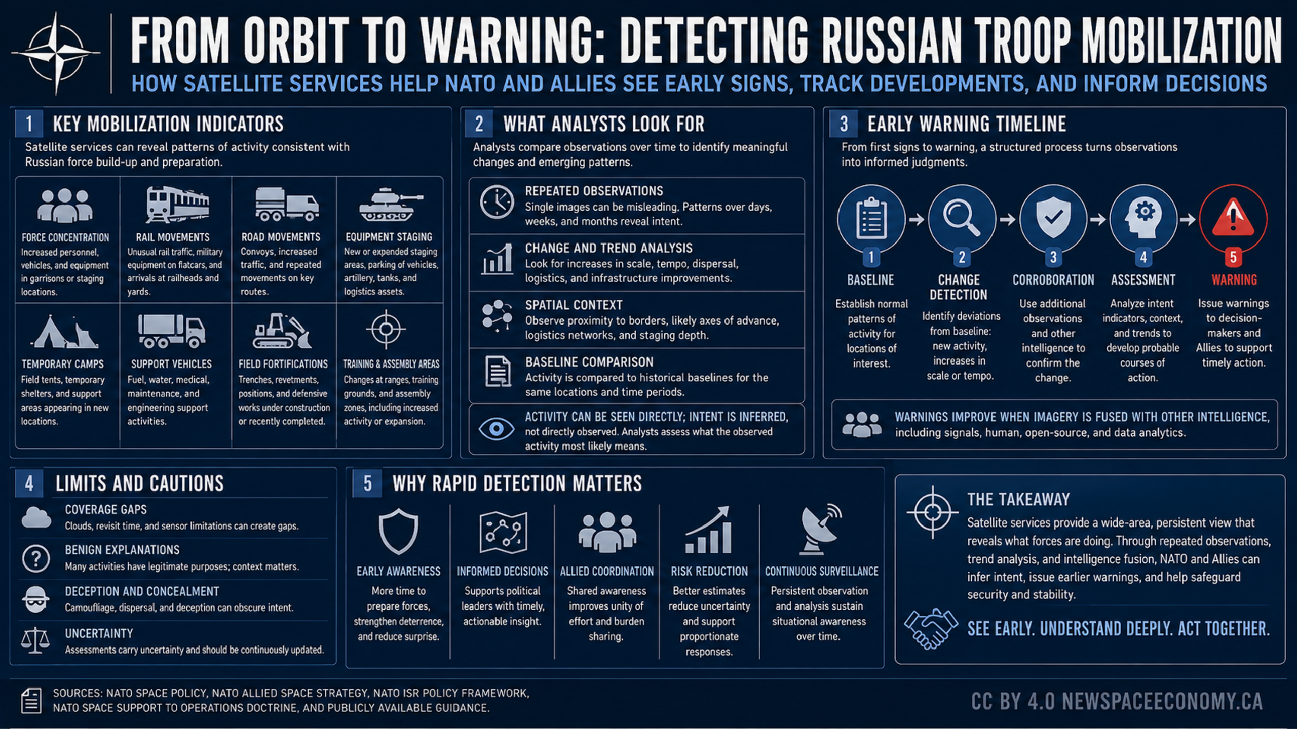
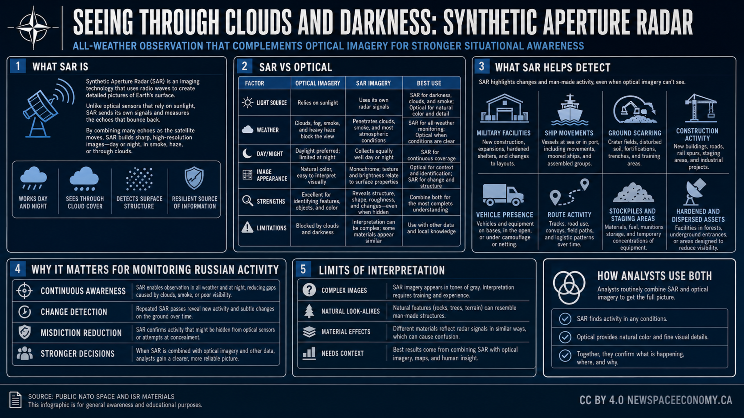
An infographic outlines how satellite imagery can support analysis of air base activity, aircraft deployment, logistics, maintenance, air defenses, and readiness signals. It also emphasizes the limits of imagery interpretation and the need to compare patterns over time and assess multiple sources of evidence.

More From This Group