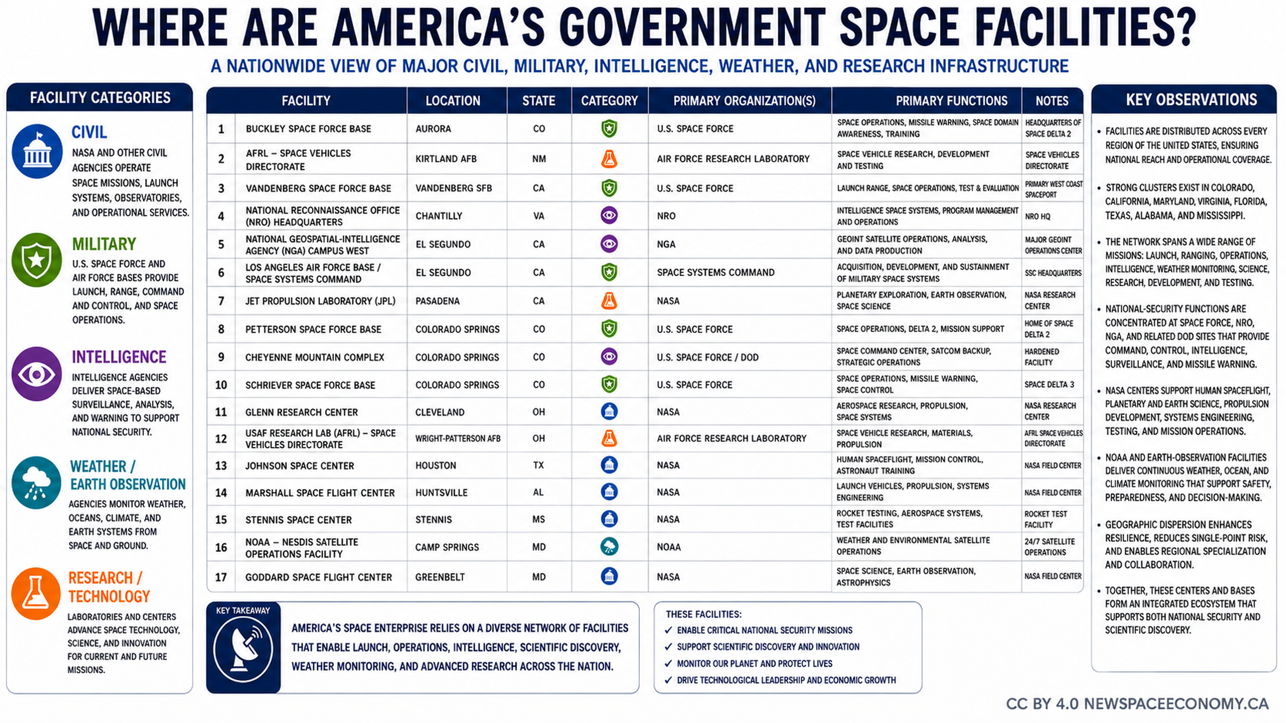
A nationwide map identifies government space facilities across the United States, including civil, military, intelligence, weather and Earth observation, and research sites. The infographic labels facilities from the Pacific Northwest to the National Capital Region and Florida.
More From This Group