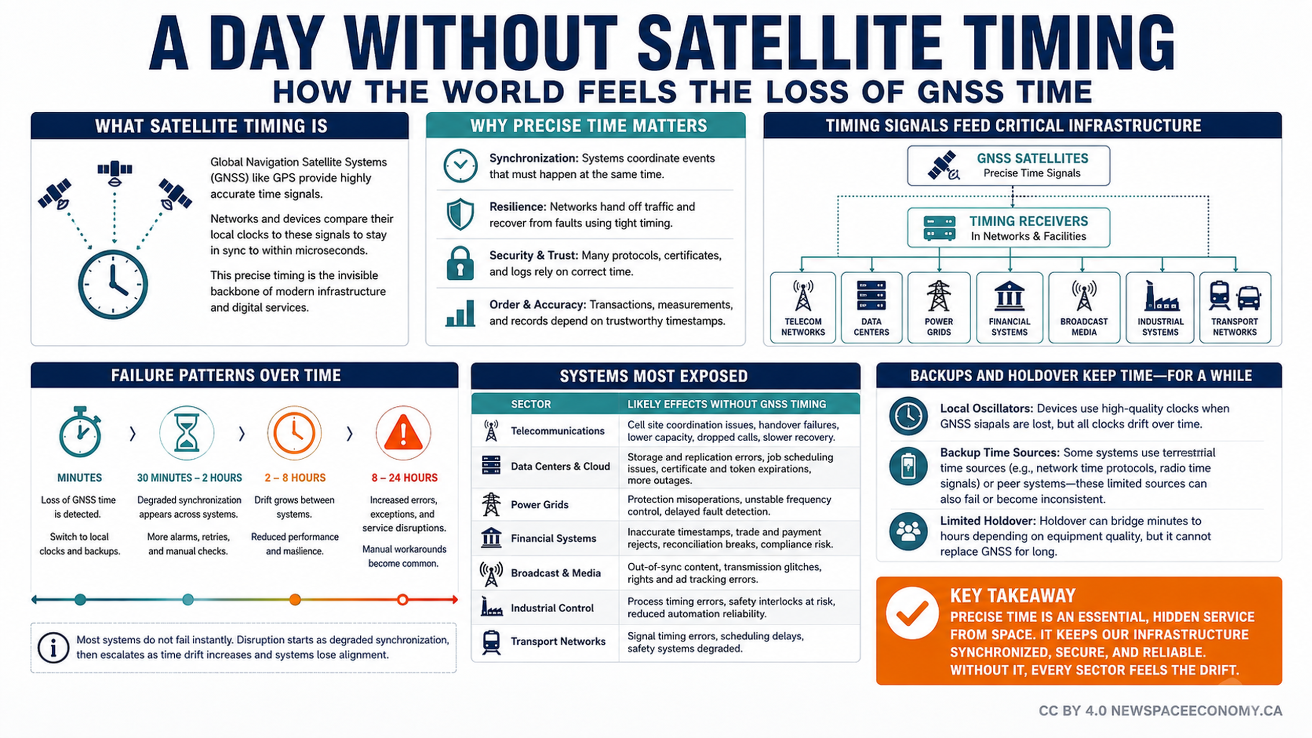
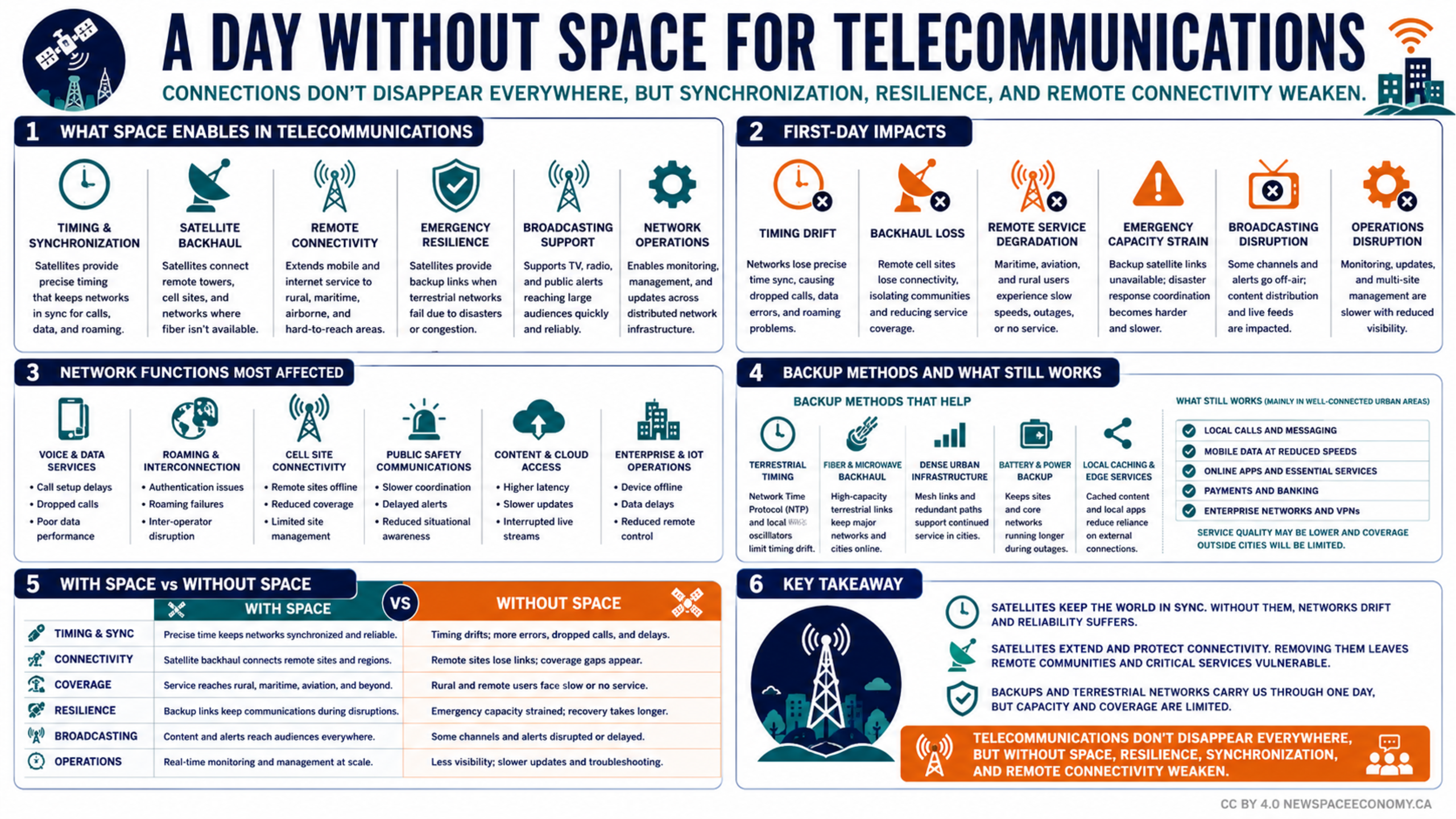
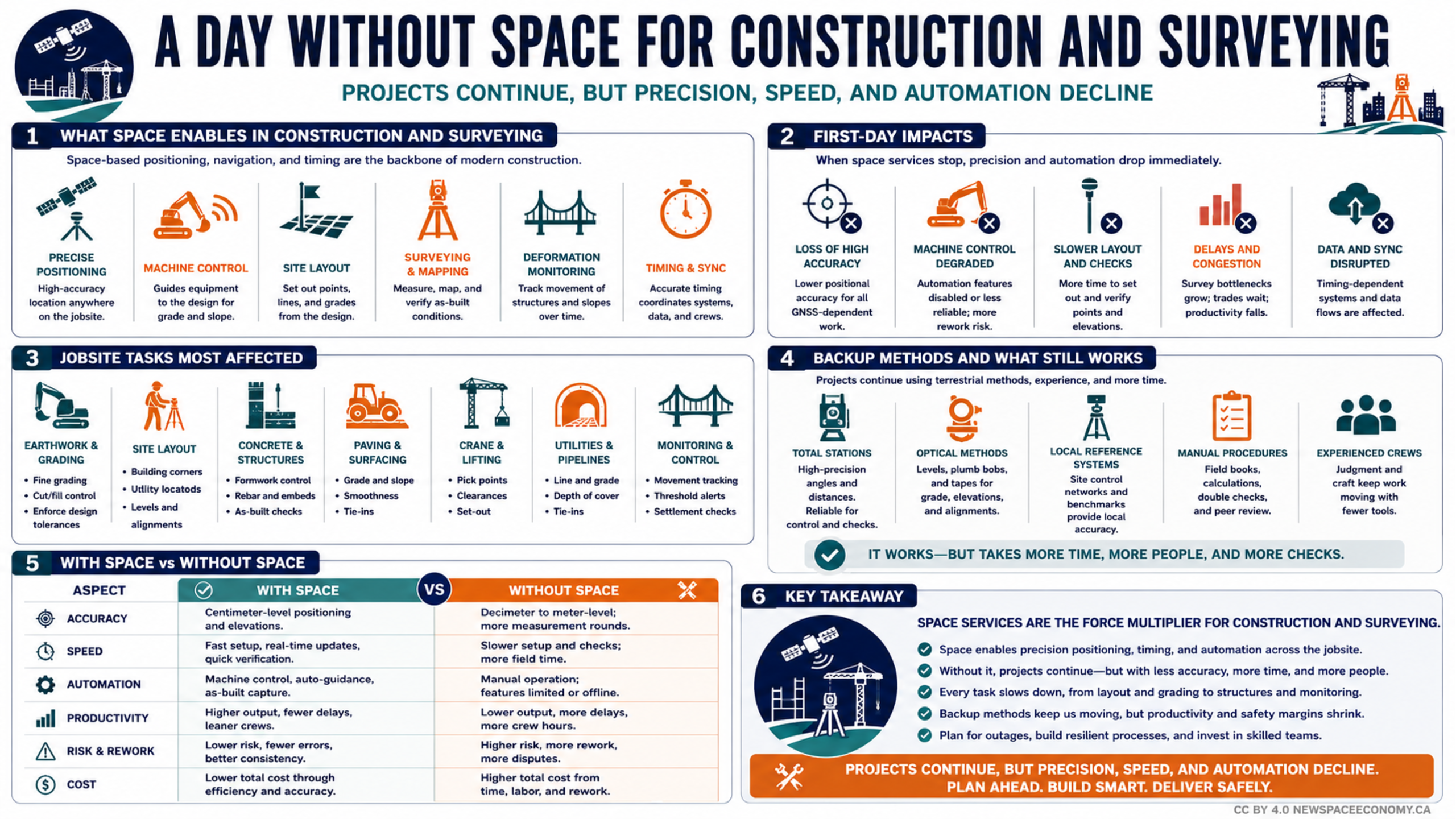
An infographic explains how satellite-based observation, communications, navigation, weather information, logistics tracking, and search-and-rescue coordination support crisis response. It contrasts normal capabilities with degraded conditions and outlines the resulting risks to decision-making, safety, coordination, and essential services.

More From This Group