
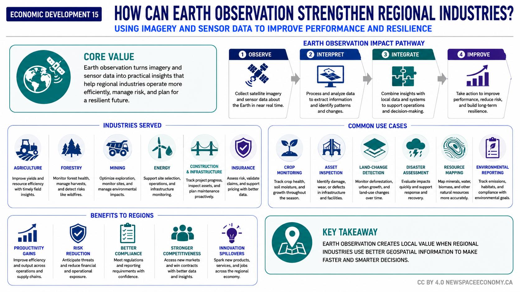
An infographic explains how satellite imagery and sensor data can support regional industries and local decision-making. It connects Earth observation with industry applications such as crop monitoring, infrastructure inspection, resource mapping, disaster assessment, and environmental reporting.
More From This Group


