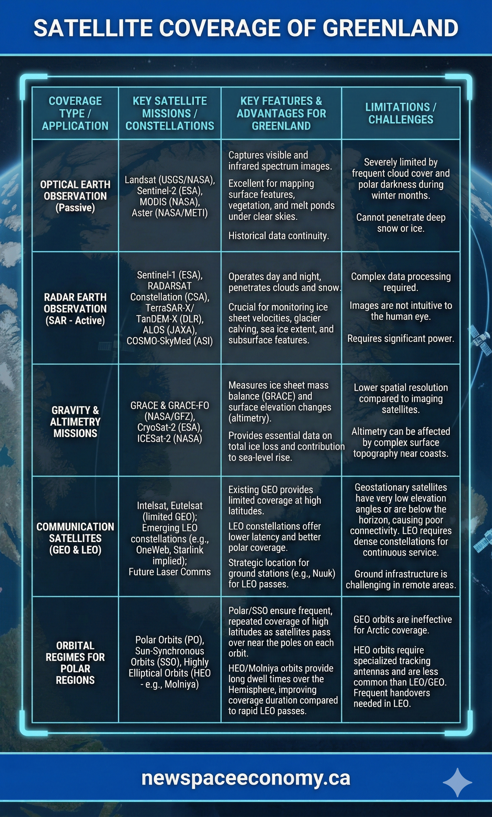
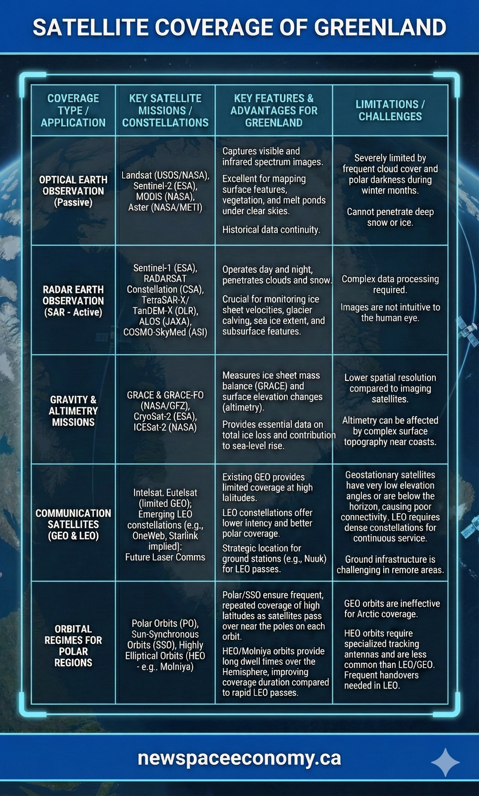
This infographic compares satellite approaches used to observe and communicate across Greenland and other polar regions. It outlines representative missions, their applications and advantages, and constraints such as cloud cover, darkness, orbit geometry, processing requirements, and remote infrastructure.
More From This Group