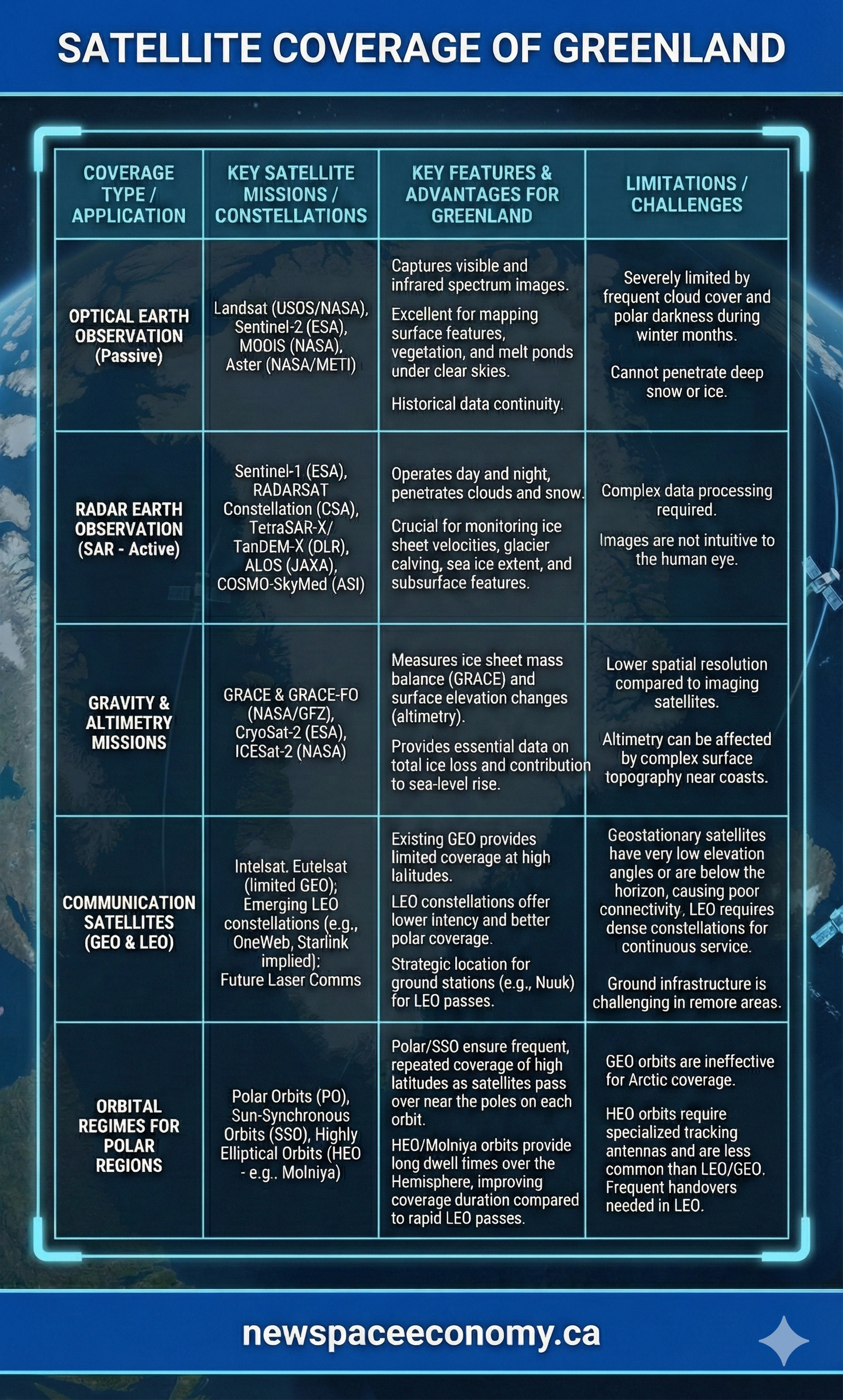
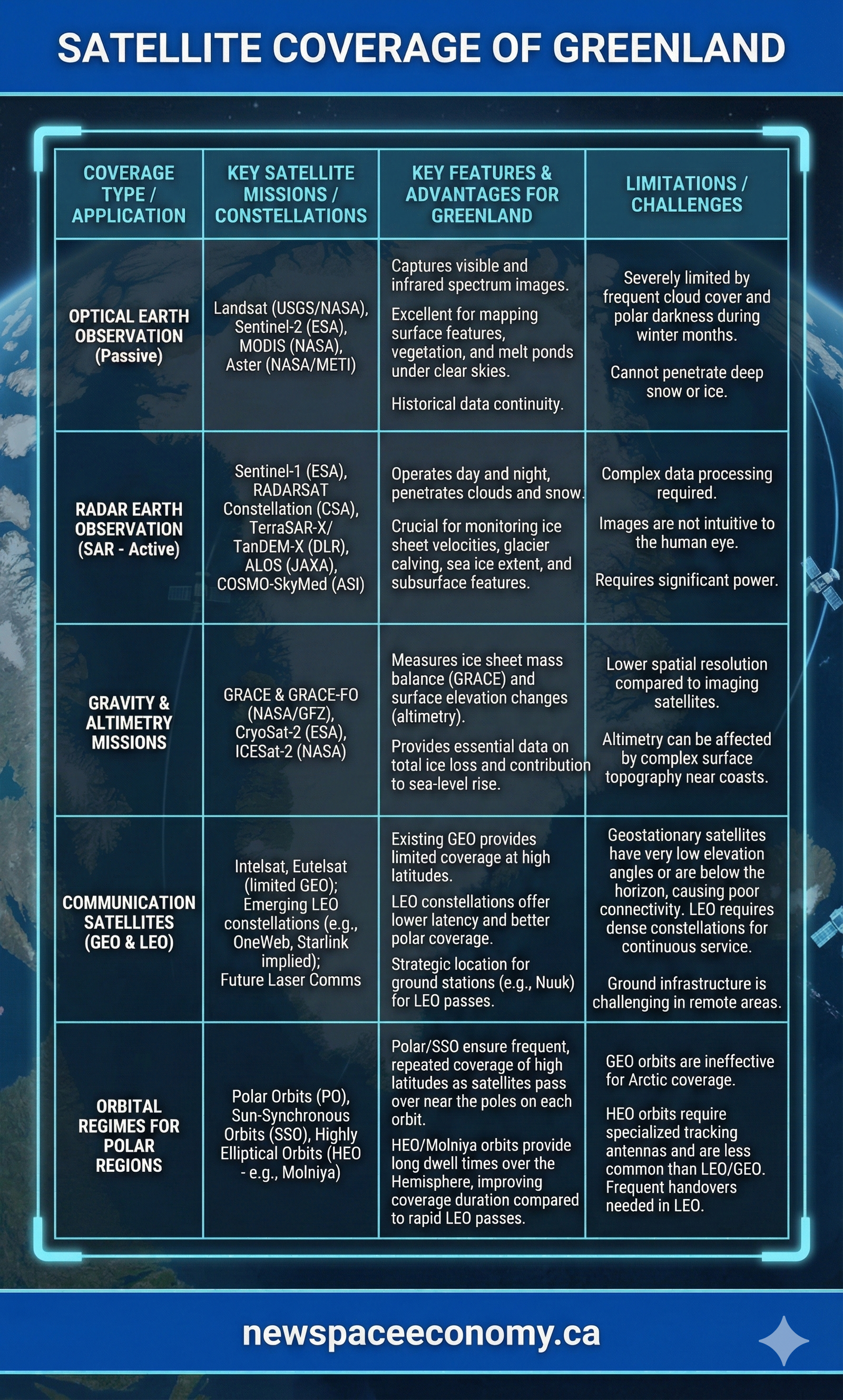
A comparison of satellite-based methods used to observe and communicate across Greenland. The infographic covers optical and radar imaging, gravity and altimetry measurements, communications satellites, and orbital choices for polar regions, including their uses and constraints.
More From This Group