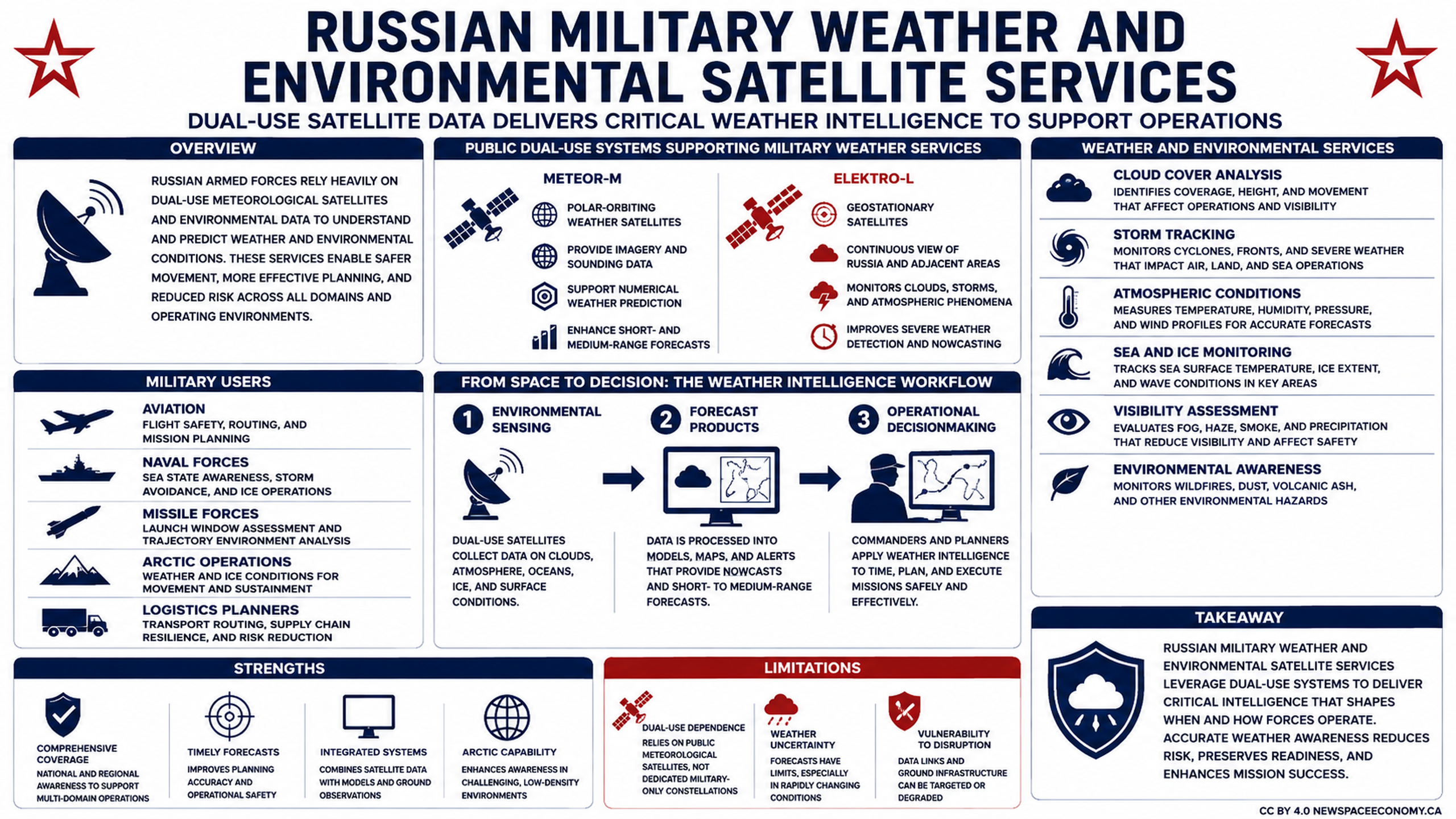
This infographic outlines the collection and processing of satellite data for military weather intelligence. It links environmental sensing to forecast products and operational decisions, while noting benefits such as timely forecasts and Arctic capability alongside weather uncertainty and dependence on public satellite systems.
More From This Group