Key Takeaways
- Kuva’s combined satellite approach raised reported classification accuracy from 71% to 75%.
- Screening could help authorities focus expensive imagery and analyst time on higher-priority fields.
- Further customer testing could establish a commercial service with repeat monitoring contracts.
Satellite Poppy Detection Produces a More Focused Search
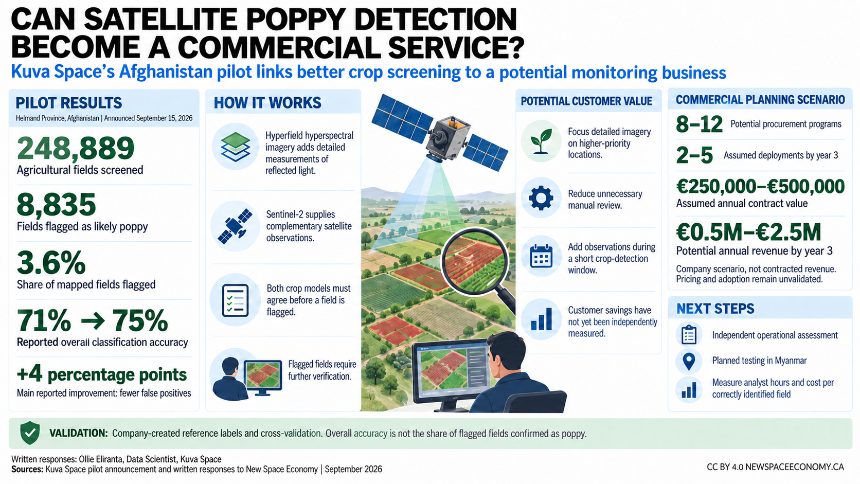
Kuva Space screened 248,889 agricultural fields in Afghanistan’s Helmand Province and identified 8,835 as likely opium poppy fields in a demonstration announced on September 15, 2026. Combining its Hyperfield hyperspectral imagery with Sentinel-2 observations increased reported overall classification accuracy from 71% to 75%, principally by reducing false positives.
The practical proposition is straightforward: screen a large region, then direct detailed imagery and analyst attention toward fields most likely to warrant investigation. Kuva’s pilot description positions the service as a way to prioritize verification, with flagged fields remaining predictions rather than confirmed detections.
The result offers an encouraging starting point for a specialized Earth observation service. In written responses to New Space Economy, Olli Eloranta, Data Scientist at Kuva Space, explained that independent operational evaluation and customer-confirmed savings remain the next steps.
Two Satellite Sources Improve Crop Classification
Hyperspectral sensors measure reflected light across many narrow wavelength bands, helping distinguish vegetation through differences associated with plant characteristics. The European Space Agency’s Sentinel-2 mission provides complementary observations in 13 spectral bands.
Kuva created agricultural field boundaries using a separate mapping model adapted to local conditions. Eloranta explained that the combined crop classifier identified a parcel as poppy only when the Hyperfield and Sentinel-2 models agreed.
That agreement rule produced a more selective output. Fewer false positives could mean less time investigating legal crops, although further evaluation must also measure how many actual poppy fields the system misses.
This progression from satellite measurements to operational decisions is central to commercial Earth observation. New Space Economy’s coverage of NASA Earth Action explores the same need to connect scientific observations with practical user requirements.
The Accuracy Gain Provides a Basis for Further Testing
The increase from 71% to 75% represents four percentage points, equivalent to approximately 5.6% relative improvement in accuracy. Using the rounded figures, the overall error rate declined from 29% to 25%, a relative reduction of approximately 13.8%.
According to Eloranta, Kuva evaluated performance against an internally produced reference dataset using k-fold cross-validation. This method repeatedly trains and tests a model on different groups of labeled examples, keeping the evaluated examples outside the corresponding training group.
The result supports continued development, but it does not mean that 75% of flagged fields are confirmed poppy. That would require a separate measure called precision: the proportion of positive predictions that prove correct.
The 8,835 flagged parcels represent approximately 3.6% of mapped fields. This creates a focused investigation queue, although it does not establish a corresponding reduction in workload compared with the customer’s existing process.
Eloranta said the customer had not conducted a separate independent assessment of operational value. Such testing could connect the classification improvement to confirmed detections and missed fields, together with the time required to investigate each alert.
Customer Value Could Come From More Selective Follow-Up
Eloranta identified reduced purchases of very-high-resolution imagery and lower manual review requirements as potential benefits. Both follow logically from a screening service that reliably directs attention toward more promising locations.
He estimated that detailed imagery across the study area could cost tens or hundreds of thousands of euros. That figure remains indicative, rather than a documented expenditure avoided by the customer, and his responses did not provide customer-confirmed net savings.
A meaningful comparison would measure Kuva’s service against the authority’s existing monitoring process. It would account for the service fee and integration costs, then measure changes in imagery purchases and analyst effort.
Saved time could also expand investigative capacity without reducing payroll costs. Broader coverage or more timely observations may justify expenditure even when total spending remains unchanged.
New Space Economy’s discussion of satellite water-level data examines a similar opportunity: better use of observations can increase their practical value. Eloranta proposed measuring analyst hours saved and cost per correctly identified field in a future operational assessment.
A Defined Commercial Scenario Gives Development Direction
Eloranta described the project as a European Space Agency Copernicus Contributing Mission demonstration. The official Hyperfield program description explains that pilot activities evaluate data quality and delivery against Copernicus requirements.
In his September 2026 written responses, Eloranta outlined Kuva’s estimate of a near-term market comprising eight to 12 procurement programs or buying centers. The company’s planning scenario assumes two to five annual or repeat deployments within three years, at annual contract values of €250,000 to €500,000.
Those assumptions imply annual revenue of €0.5 million to €2.5 million by year three. Eloranta emphasized that these are scenario-based estimates rather than contracted revenue, with pricing and adoption assumptions still requiring commercial validation.
The estimate nevertheless gives the application a defined commercial target. Kuva can test whether repeat deployments generate sufficient customer benefit and whether delivery costs leave an acceptable margin.
Expansion Could Build Evidence for Repeat Deployments
Eloranta identified Myanmar as Kuva’s next planned test geography. UNODC findings reported by Reuters in December 2025 estimated that the country’s poppy cultivation increased 17% in 2025, reaching 53,100 hectares.
Testing there would help establish whether the approach transfers beyond Helmand. Successful deployment would require locally credible reference data and evidence that performance remains useful under different growing conditions.
Eloranta also said Kuva expects its next-generation Hyperfield-2 satellites to improve accuracy toward 90%. That remains a company expectation requiring demonstration, but it identifies a further development path alongside improvements to training data and customer workflows.
Summary
Kuva’s demonstration provides an encouraging technical result and a plausible route to a focused commercial service. Combining satellite sources improved reported classification accuracy and produced a selected set of locations for further investigation.
The next opportunity is to demonstrate customer value through an agreed operational trial. Evidence of better detection, reduced follow-up costs, or expanded monitoring capacity could support repeat purchases and establish a clearer basis for pricing.