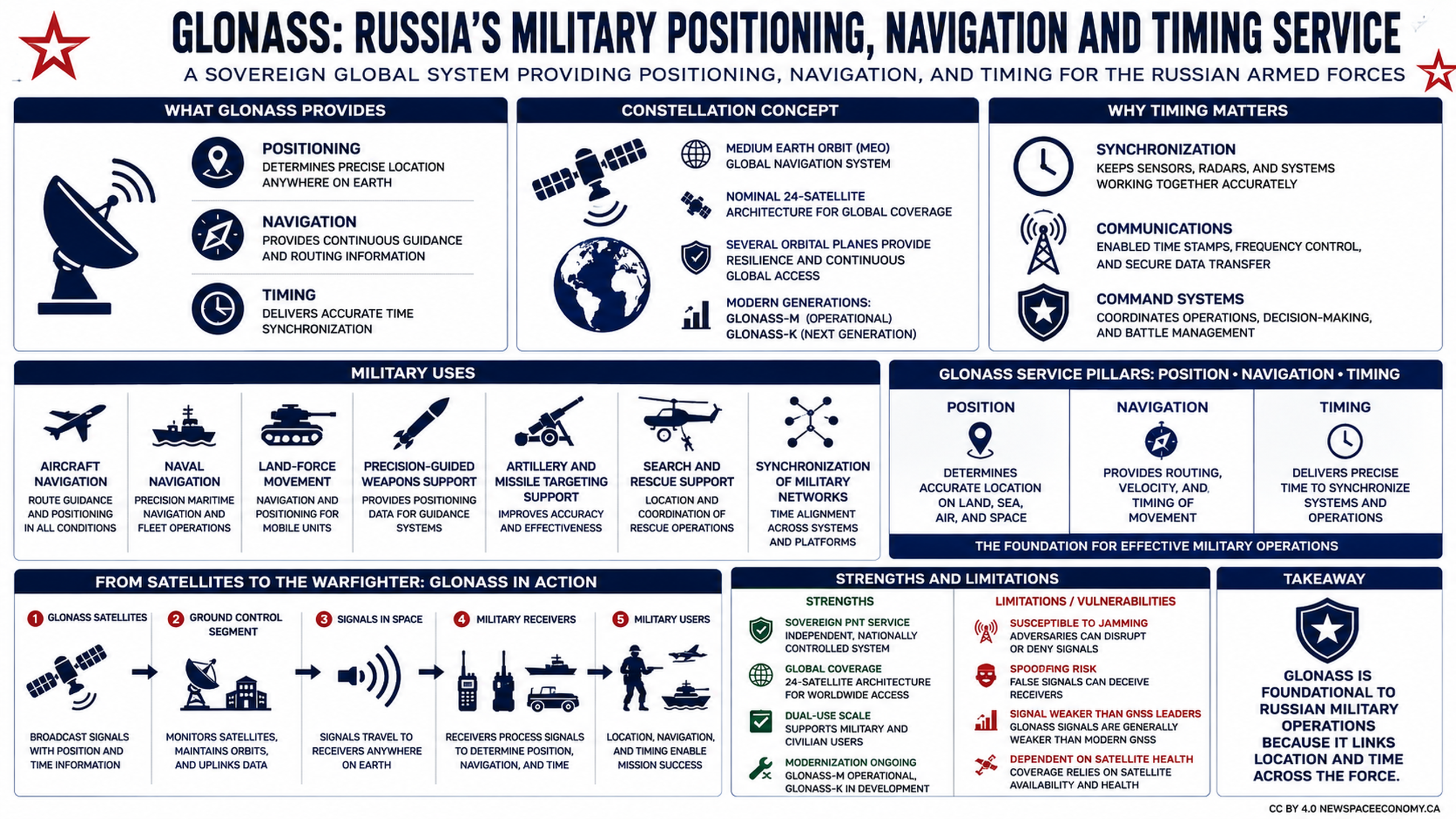
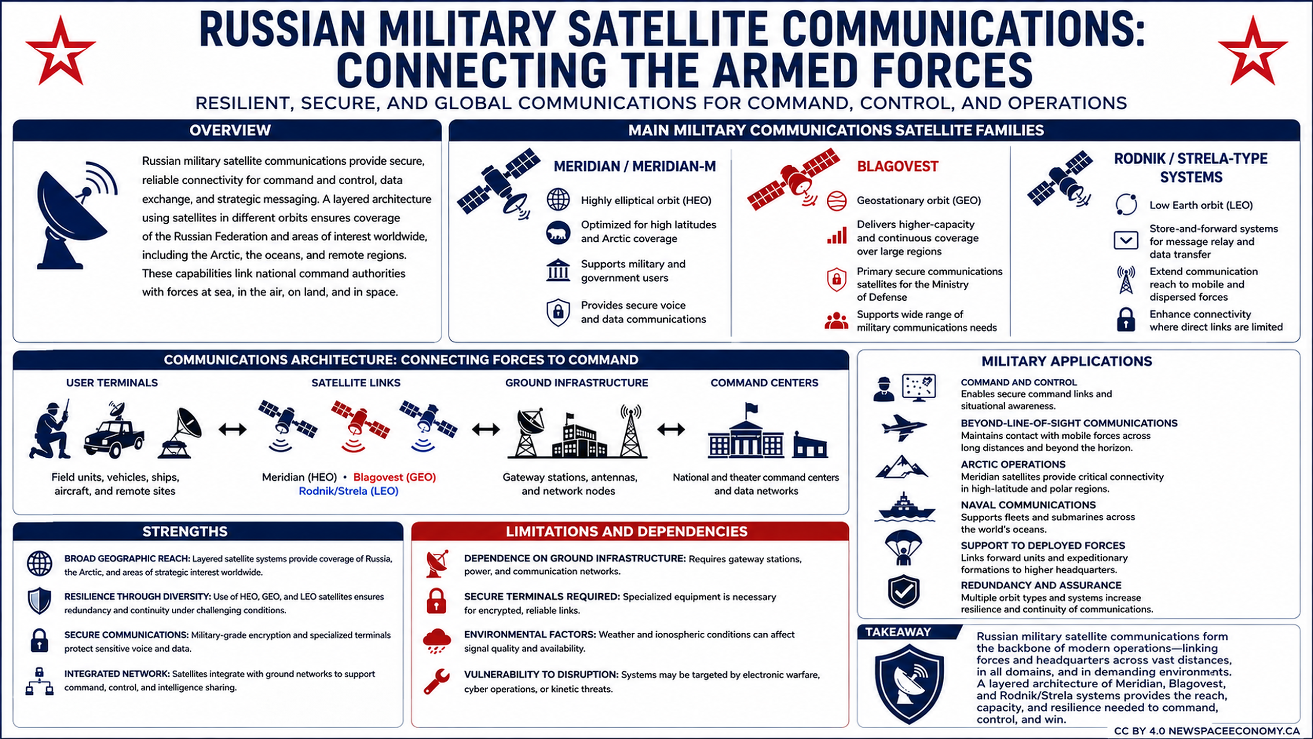
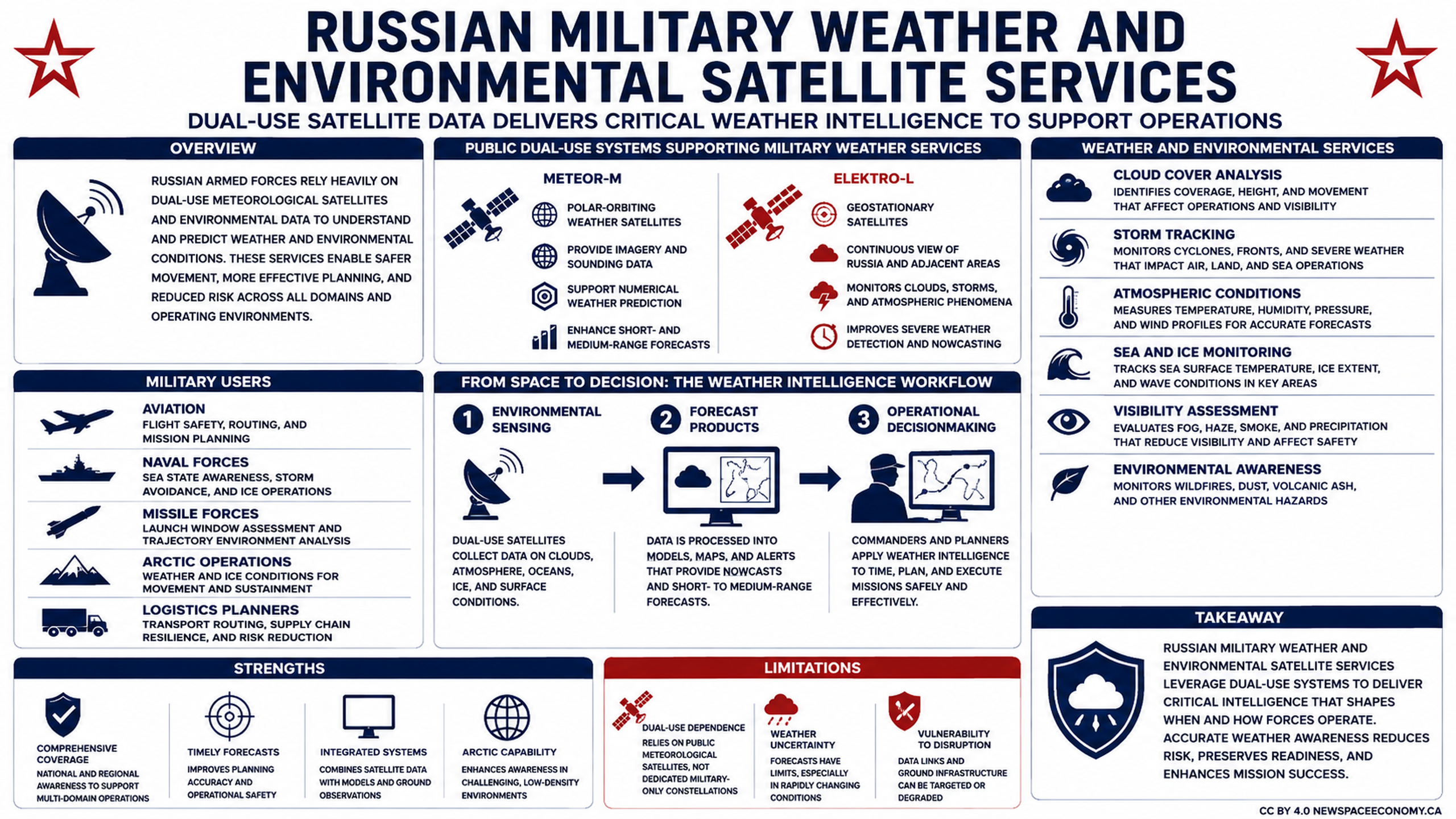
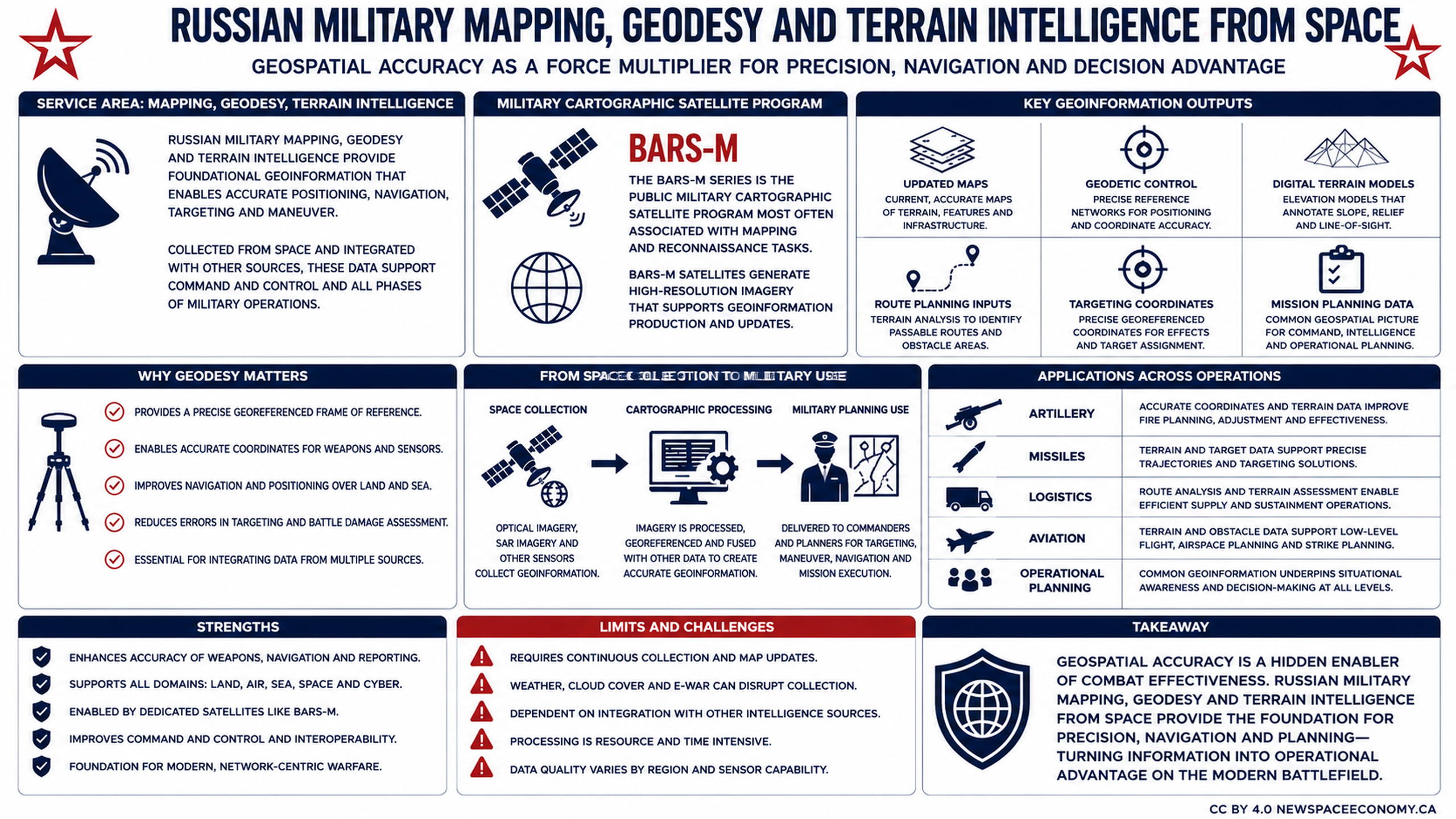
This infographic outlines the role of space-collected geospatial information in Russian military operations. It covers BARS-M satellites, cartographic processing, geodetic control, terrain models, operational applications, strengths, and challenges.
More From This Group