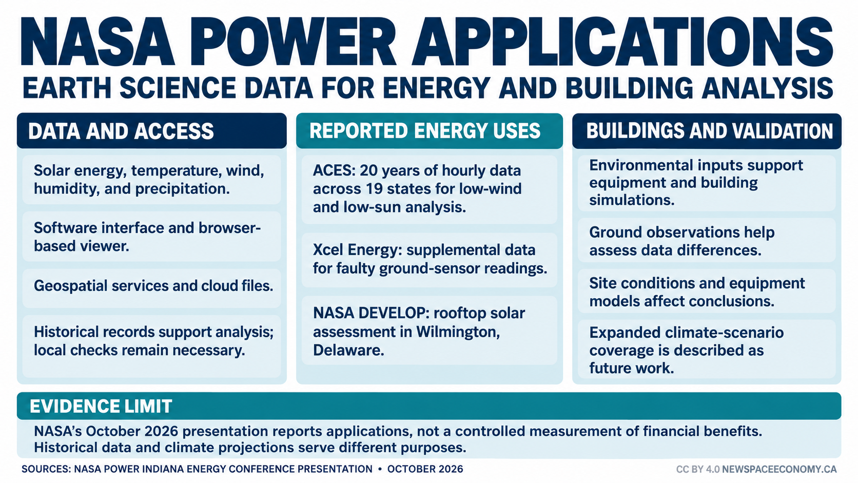
NASA POWER supplies solar and meteorological data that organizations use in electricity planning, building analysis, and other terrestrial applications. An October 2026 presentation prepared for the Indiana Energy Conference describes how utilities, engineering firms, and public agencies incorporate the service into their work. The examples show how Earth science data becomes an input to practical decisions, with analysis and local validation still required after the data is obtained.
The conference presentation reports applications ranging from identifying periods of low wind and sunshine to supplementing unreliable ground measurements. NASA’s repository lists October 7 as its distribution date; the conference began October 6. The document reports user experiences and service capabilities, rather than a controlled evaluation proving a uniform financial benefit across every application.
POWER stands for Prediction Of Worldwide Energy Resources. Operated through NASA Langley Research Center, the service combines Earth observations and model-derived information in forms intended for energy, building, and agricultural users. Variables include incoming solar energy, temperature, wind, humidity, and precipitation. These describe environmental conditions that influence equipment performance and energy demand, rather than directly prescribing an investment or operating decision.
The POWER service offers several routes to its data. An application programming interface allows software to request information directly, reducing the need to download individual files by hand. A browser-based viewer supports selecting, visualizing, and downloading data. Geospatial services and cloud-hosted files provide additional options for organizations working with mapping systems or larger analytical workflows.
These access methods matter because useful observations must fit the software and units used by practitioners. A building analyst may need weather information organized for a simulation, and an electricity planner may need hourly records covering multiple locations. Providing data through familiar formats can reduce preparation work. It does not remove the need to check variable definitions, time conventions, missing values, and suitability for the specific calculation.
One example in the presentation concerns ACES, which analyzed 20 years of hourly data across 19 states for Platte River Power Authority in northern Colorado. The purpose was to identify periods with little or no wind or sunshine. Such periods matter for an electricity system because several renewable generators can experience low output during the same interval. A long record helps analysts examine combinations that a short local series might not capture.
That analysis is a planning input, not a prediction of the exact timing of the next shortage. Generation adequacy also depends on electricity demand, the installed equipment, storage, transmission access, and other available supply. Historical environmental records allow planners to test assumptions about those resources. The resulting conclusion depends on the energy-system model and the conditions represented, as well as the quality of the underlying weather data.
A second example involves Xcel Energy’s monitoring of community solar installations. The presentation says the company uses hourly solar, precipitation, wind, and temperature information from POWER’s cloud files to supplement bad readings from ground sensors. An independent environmental record can help analysts investigate whether unusual production coincides with weather conditions or a measurement problem. It does not establish the cause of every discrepancy without further evidence.
Satellite-derived and model-derived data describe areas differently from instruments installed at a particular site. A ground sensor may capture a local condition that a broader dataset cannot resolve, and the ground instrument may itself have faults. The useful comparison considers both possibilities. Replacing every site measurement automatically would discard information needed to distinguish local weather, equipment behavior, and sensor error.
The presentation also describes a NASA DEVELOP project supporting the Delaware Department of Natural Resources and Environmental Control. The team used POWER solar data in an assessment of rooftop locations in Wilmington for community solar. That is evidence of data supporting site assessment, not confirmation that every identified rooftop has an installed system. Construction suitability, ownership, financing, and electrical connections remain separate project requirements.
Buildings provide another set of applications. NASA reports that Gamma Technologies incorporates POWER data into simulation software for analyzing ambient conditions affecting machinery, energy systems, and industrial facilities. The presentation also identifies uses by engineering and design organizations and by a roofing manufacturer. These examples concern environmental inputs to technical analysis; the briefing does not independently quantify a common reduction in energy consumption or maintenance costs.
For buildings, temperature and humidity can affect heating, cooling, and moisture-related calculations. Wind and solar conditions can influence exposure and energy performance. The practical benefit of an accessible dataset is that designers can examine those conditions consistently across candidate locations or periods. A simulation still needs an appropriate representation of the building, its equipment, and its intended operation before it can support a design conclusion.
NASA includes comparison with surface observations in the service’s validation tools. Those tools help users assess differences between satellite-based or assimilated products and measurements made at ground sites. Validation is particularly relevant when an application depends on extremes or local conditions. Agreement in a regional average does not automatically establish accuracy for a specific rooftop, facility, or hour.
The commercial contribution can occur after public data delivery. Engineering firms can combine environmental records with equipment models, site information, and customer requirements to produce a decision-specific service. New Space Economy’s discussion of Earth observation for energy infrastructure describes related applications in asset monitoring. POWER’s examples concern environmental analysis rather than implying that its datasets perform every form of infrastructure inspection.
The briefing identifies expanded long-term climate-scenario coverage as future work, including broader coverage across the contiguous United States, Alaska, and Hawaii. Climate projections describe possible conditions under specified models and emissions assumptions. They should not be confused with observed historical records or precise forecasts for an individual future day. The presentation’s future-work section does not establish that the proposed expansion is already complete.
NASA POWER’s reported applications show where a public data service can support operational and engineering analysis. Its usefulness depends on matching the environmental information to the decision, documenting uncertainty, and retaining necessary local evidence. For utilities and building professionals, the supported outcome is better access to analytical inputs; the quality of the resulting decision still depends on how those inputs are used.
Useful Books Available on Amazon